|
Real Rock Route
|
|
Sunday - Tuesday, August 5 - 7, 2018 |

|
2016 had not been a good year for weather on Granite peak, as our
Highpointers Club group
had been stormed off the Southwest Couloir/Ramp route. This year,
I opted for the more-traditional Froze-to-Death Plateau approach and
the rock-climbing route guided by
Jackson
Hole Mountain Guides. I had
climbed with them in 2016 when we succeeded in summiting Gannett Peak in
Wyoming, so I was happy when Eddie Schoen's schedule and mine synched
up for this attempt at Granite Peak. Having climbed with Eddie before,
I was very comfortable trying this more-technical peak and Eddie knows
my capabilities (and limitations), so that was a good sign for this attempt.
The route out to Montana is now a familiar one, I-70 west to Kansas City,
I-39 north into Nebraska and then I-80 across Nebraska and Wyoming. My
pre-climb destination was Cody, WY, where the JHMG group would meet on
Wednesday.
|
|
Wednesday, August 8, 2018 |
|
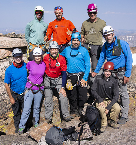
After the leisurely three-day drive out from St. Louis, the group met in Cody, WY, for a gear shakedown and a day of training on the climbing and rope techniques to be used on Granite. The group consisted of seven climbers (one of whom opted not to try for the summit), three guides and two porters. |
|
Thursday, August 9, 2018 |
|
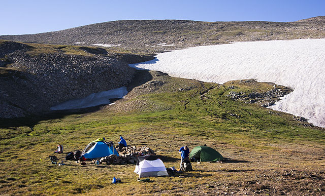
On Thursday morning, we met up in Red Lodge, MT, for breakfast before
driving up to the trailhead for Granite Peak. With everything packed
and ready, we headed in for our 8-mile hike to a campsite on
Froze-to-Death Plateau.
The trail is straightforward but strenuous until the last mile or so,
where we cut cross-country to our campsite for the evening. With a
lingering snowfield just above the campsite, we had a good water supply.
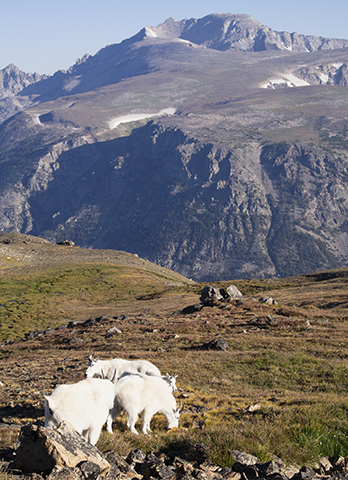
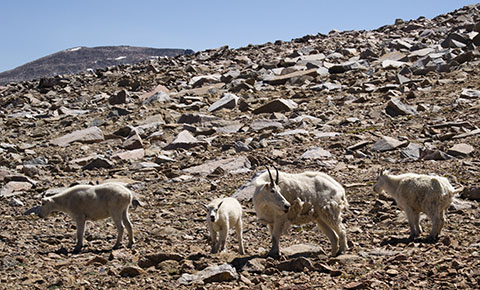
The welcoming committee of mountain goats greeted us as we set up camp.
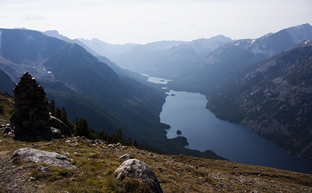
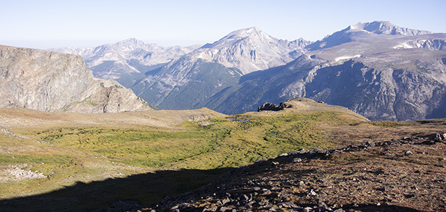
Lakes and Mountains along the Trail |
|
The mountain goats around Granite Peak are unafraid of humans. While they aren't particularly aggressive, they are assertive about accompanying poeple as you go off into the rocks to use the facilities. Their need for minerals makes them quite interested in human urine, so they watch nearby until you're finished and then lick up the puddle.
|
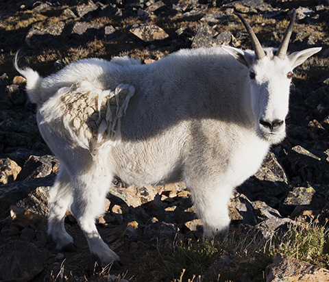
Several of the goats looked rather scruffy, as they were still in the process of shedding their heavy winter coats. Walking around, we would often see small tufts of hair clinging to the rocks. |
|
First Night's Camp at Froze-to-Death Plateau |
|
Turning around, the view from our camp over Froze-to-Death Plateau, across the valley and to the mountains on the other side was spectacular. Definitely "a room with a view" for the night. With the snowfield above camp, we had a good water supply, as well.
View from Camp at Froze-to-Death Plateau |
|
Friday, August 10, 2018 |
|
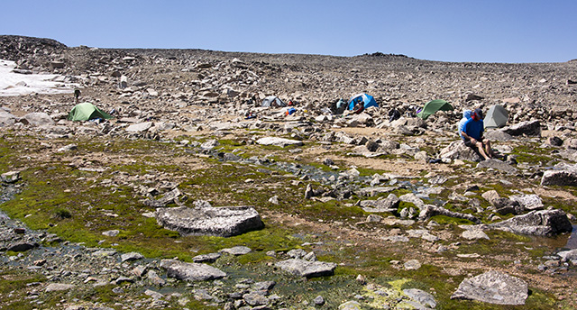
Our second day's hike would be shorter but more rugged. We ran out of trails and navigated cross-country to another site with several rock walls built up as wind shields around tent sites. Once again, we had runoff from a remnant snowfield providing plenty of water. |
|
|
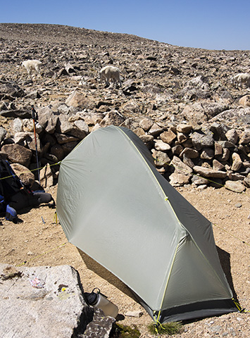
JHMG had provided a one-person tent for me which was lighter than my usual Walrus "Swift" tent. It was interesting because it was so narrow that I had to crawl in backwards since there wasn't room to turn around once inside. However, losing a pound of packed-in weight for three nights of close quarters was worth it. |
|
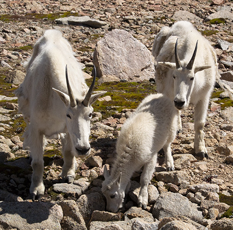
Our high camp came with its own welcoming committee of mountain goats. This time, there were some little ones as well as adults. The goats here were not quite as assertive as at our camp on Froze-to-Death Plateau but were still unafraid and wandered through our camp with no concern over the two-legged interlopers.
|
|
|
Saturday, August 11, 2018 |
|
|
We arose very early the next morning in order to get started on our summit bid
by 4 a.m. We hiked by headlamp the first couple of miles. Once we crested the
first ridge, there was a decent use trail to follow down to the second
ridge we had to cross. Yes, we had to go down before starting back up. As we came
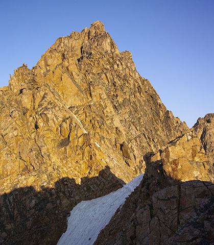
over the second ridge, we were treated to our first real glimpse of Granite Peak,
which hides itself out of view behind intervening ridges for the first two-plus
days.
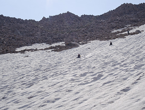
There was a short pitch of rather steep snow to cross before we started the climb
to the summit. Without ice axe and crampons, the JHMG guides set up a belay in case
anyone slipped out of the boot track across the snow. No problem, as we made it
across easily and then started the mixed climbing up a series of slopes and chutes
to the summit of Granite Peak.
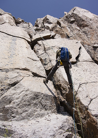
As is well described in the guide books, the final climb is a mixture of exposed 3rd-class
scrambling, 4th-class climbing and a couple of pitches of easy 5th-class climbing. We
climbed the 3rd-class pitches free but Eddie belayed us up the 4th- and 5th-class pitches.
We topped out in brilliant sunshine and a light breeze about 10:30 a.m.
|
|
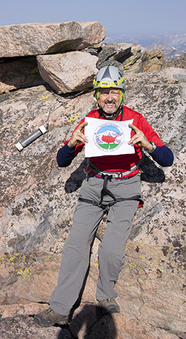
The summit block is marked with a USGS benchmark. We shared summit photo duties and spent
an hour or so enjoying the view from the highest point in Montana before starting our
descent and return back to our high camp.
This summit ticked off my 48th state highpoint. Not the 48 (as in the 48 conterminous
states) since Nathan and I did Hawai'i a few years ago. Still left on the to-do list are
Boundary Peak, NV, and (possibly) Denali Peak, AK. It felt good to know that the only
remaining highpoint in the lower 48 is a relatively easy scramble, having now completed
the really tough ones in the western states.
|
|

|
|
It was good to have shirtsleeve weather for summit photos. There were a few other folks who came up either by the traditional route or the newer Southwest Ramp route, so we traded off group summit photo duties. Our intrepid group of six climbers plus three guides all reached the summit within the span of about 15 minutes. The JHMG guides are great at leading climbers of varying abilities up a challenging route. The group ranged in ages from teens through sixties, so age was no deterrent. |
|
|
|
|
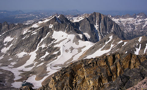
The view from the summit of Granite Peak is another reward for the effort of getting there. We definitely had a bluebird day for our summit attempt, so we took time to enjoy the view and eat lunch atop the highest peak in Montana. |
|
|
|
The rest of the route back to camp retraced our steps of the (very early) morning, regaining the altitude we lost getting to the second ridge. Once back at camp, we ate dinner and settled down for our last night on the mountain. |
|
Sunday, August 12, 2018 |
|
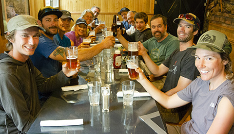
After packing up camp, we headed back to the trailhead. This would be our
longest day at about 12 miles. The first third is cross-country on a variety
of terrain. Once we picked up the trail, the hiking was only marginally
easier, as the trail is rough and rocky. My knees aren't happy with long
downhill days and I had warned Eddie that I would be slower going down than
I was going up. As it turned out, I was only about a half-hour behind the
group, so they had had time for a first beer back at the cars.
We drove back to civilization and a well-earned dinner to celebrate a safe
and successful summit of one of the most difficult of the fifty state highpoints.
I settled in for a final night in Cody, WY, before pointing the Outback east
to head home.
|
|
|
|
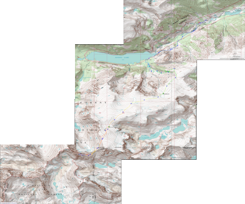
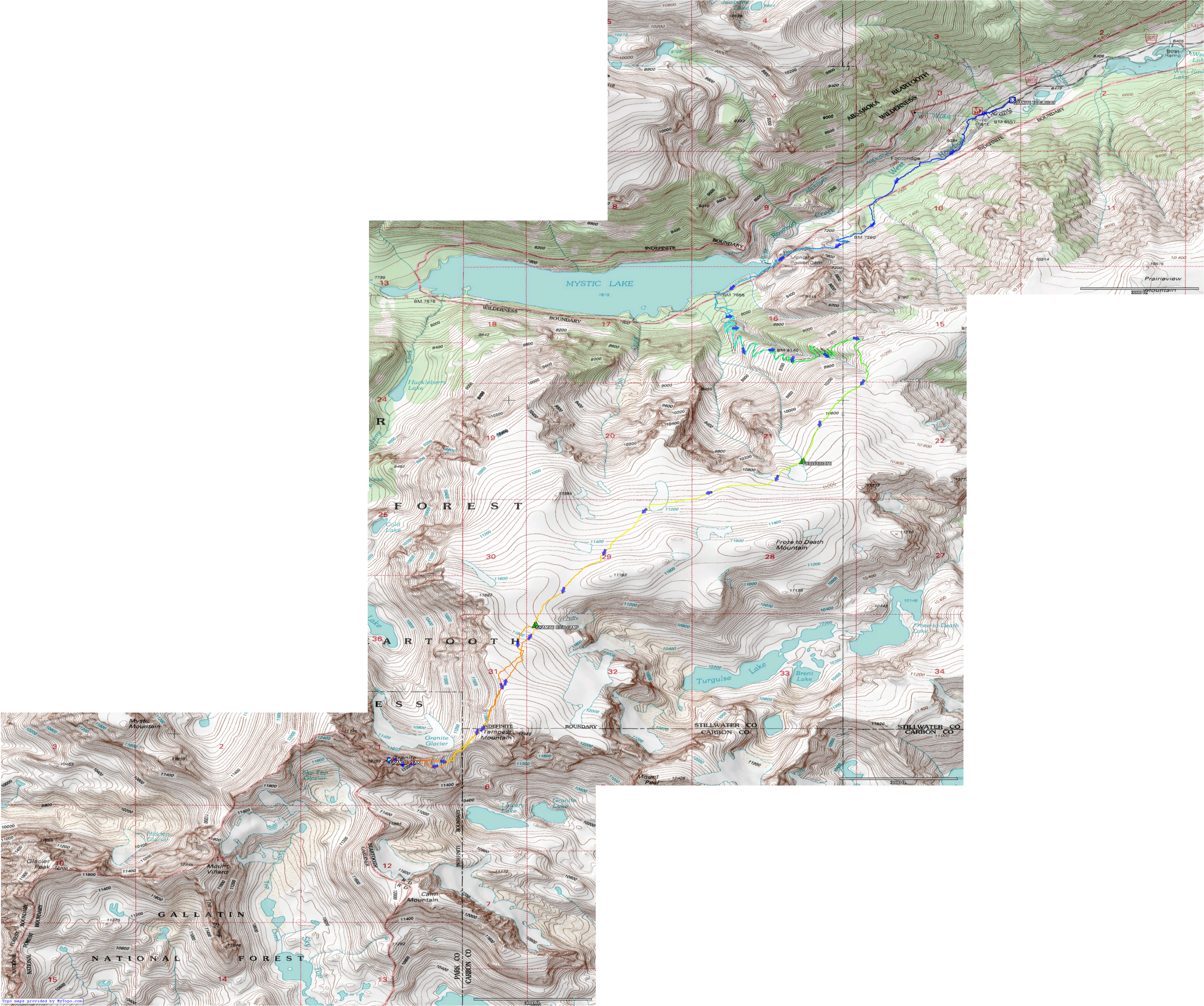
The map to the left shows our route from the Mystic Lake trailhead to the summit.
The map links to a larger version, or you may download the full 3800 x 3200 pixel,
12-megabyte map.
The trailhead is at waypoint GRANITE TRAILHEAD, 45.24581° N 109.72963° W. Our first camp
at Froze-to-Death Plateau is at waypoint FROZE2DEATH, 45.20082° N 109.75587° W. Our
high camp is at waypoint GRAMITE HIGH CAMP (pardon the typo), 45.18034° N 109.78914° W.
The summit is at waypoint GRANITE PEAK, 45.16345° N 109.80738° W. The track distances total
25.8 miles. The greatest altitude gain is on the first day, not quite 4,100'. The second
day is short (about 2.5 miles) with only 1,000' gain. The summit day is just shy of
6 miles, round-trip, with about 2,200' gain. Of course, there is a fair amount of downhill
on the way up as you go up over the ridge by Tempest Mountain at about 12,100' and down
to 11,300' before you start up to the summit itself. Having to lose and regain that
again on the way out is not the most fun, for sure.
The tracks were captured with my Garmin Oregon 450 GPS. Maps were created using
TopoFusion software. While not free, it is
reasonably priced and gives decent results, accepting the GPX files from the GPS unit
and loading topographic map tiles to cover the area of the tracks and waypoints.
|
|
Monday - Wednesday, August 13 - 15, 2018 |
|
|
|
|
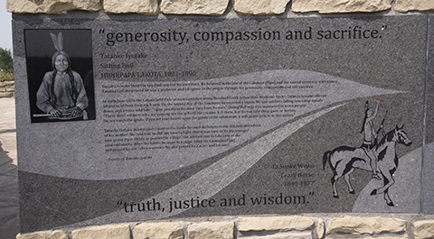
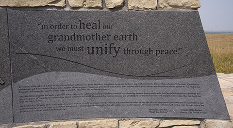
After consulting the map and Google's routing, I opted to drive a few miles farther and head north initially to I-90 rather than south to I-80 and retrace my outbound route through Wyoming and Nebraska. Along the way, I visited the Little Big Horn monument. |
|
|
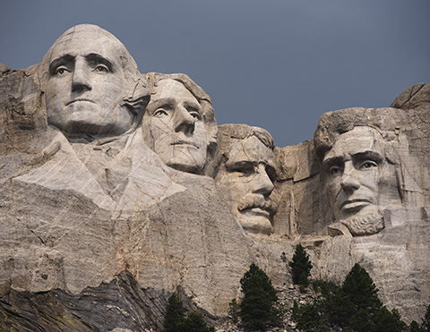
| Monday night, I stopped in South Dakota which necessitated a quick jaunt down to Mt. Rushmore. I barely beat the rain showers but managed a few photos while the sun was still shining. Lunchtime found me at Wall Drug in Wall, SD, a must-see spot for anyone wandering through that part of the country. |
|
|
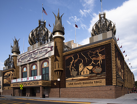
| A final stop at the Corn Palace in Mitchell, SD and I headed across the corner of Nebraska and into MO where I found motels booked up until I meandered a fair way off the interstate but still more-or-less along the way home. I arrived home on Wednesday, as planned, with my second highpoint tagged for the summer (after Mt. Hood) and a good feeling of accomplishment. |
|
Respectfully submitted by
Alan Ritter, August, 2020 |