|
Another 50/50 Trip:
|
|
Granite Peak, Montana |
|
Wednesday - Thursday, August 3 - 4, 2016 |

|
With the Highpointers Club convention being out in Montana in 2016, it seemed like a good opportunity to attempt two of the harder of the highpoints, Granite Peak in Montana and Gannett Peak in Wyoming. First on the list was Granite, with a group of folks from the club. The plan was to try the less-technical "Southwest Couloir" route rather than the traditional route up past Froze-to-Death Plateau that involves 4th and 5th class rock climbing. The photos below link to pages with larger copies of the photos if you wish to see more detail in any of them. |
|

|
|
|
Friday, August 5, 2016 |
|
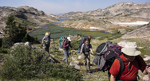
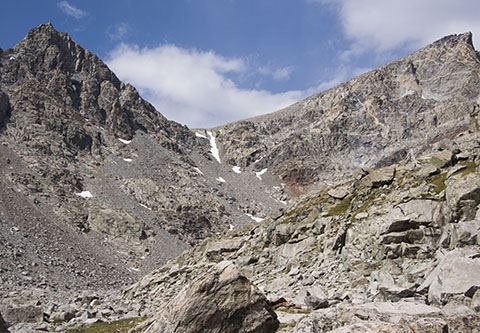
Trail? What trail? We don't need no stinkin' trail! Once you're in this valley, you're on your own to find a passable way up toward Granite Peak. You're not going to get lost but the way is rough and rocky. At this point, the weather looked lovely and promising for our summit attempt. Of course, up in the mountains, things are subject to change regardless of the forecast. |
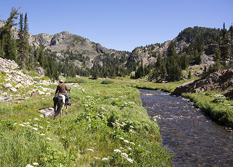
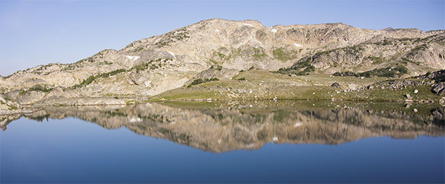
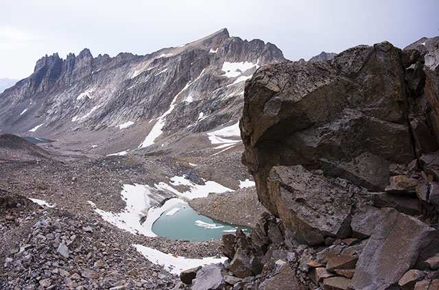
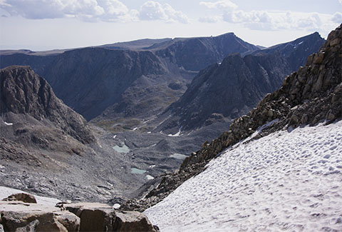
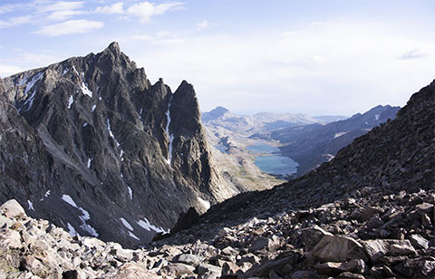
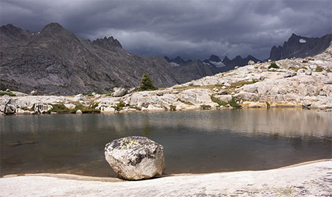
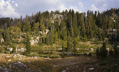
We broke camp the next morning and continued up toward our high camp. Above Rough Lake, the trail petered out and the terrain steepened as we approached the series of Sky Top Lakes. Navigation isn't an issue, as you make a left at the first of the Sky Top Lakes and follow the valley up toward Granite Peak. The intervening ridges obscure the view of Granite Peak until you're past the largest of the Sky Top Lakes, but the surrounding peaks are spectacular in their own right.
|
|
|
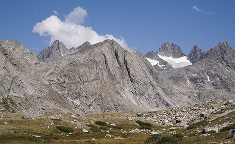
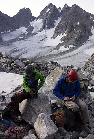
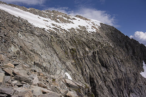
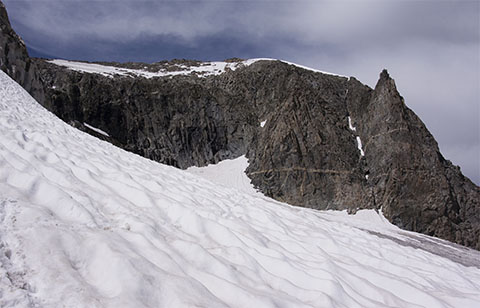
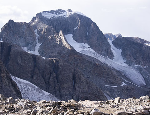
As we rounded the last of several intervening ridges extending into the valley, Granite Peak came into view. Having researched the route from Steve Eckert's excellent report, we could see the southwest couloir/ramp and visualize the climb for the next day. We settled in for the night, looking forward to a challenging climb. |
|
Saturday, August 6, 2016 |
|
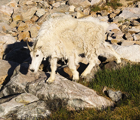
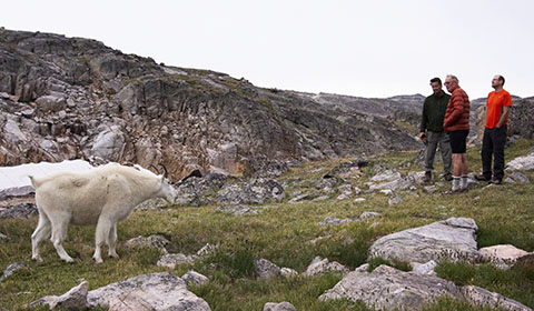
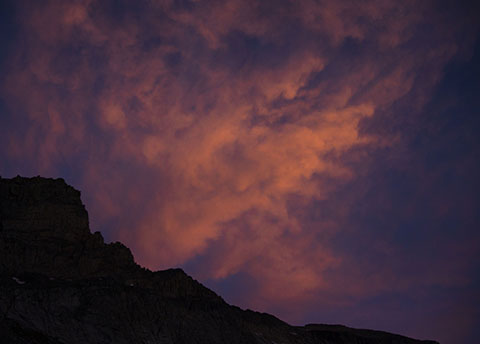
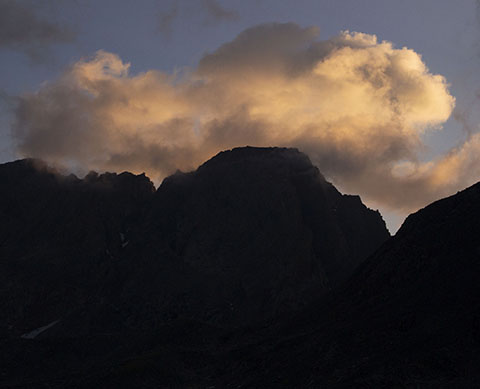
Our optimism about the weather turned out to be misplaced, as we woke up to threatening clouds over the top of Granite Peak. These soon turned into thunderstorms and we were glad we had planned an extra day into the schedule for weather contingencies. With intermittent showers during the day, we popped out of our tents in the breaks and conversed among ourselves and with the local mountain goat population that once again meandered through camp with little care about the funny two-hooved critters among them. As the saying goes, "even a bad day in the mountains is better than a good day at work," so we relaxed and prepared in hopes of better weather on the morrow.
|
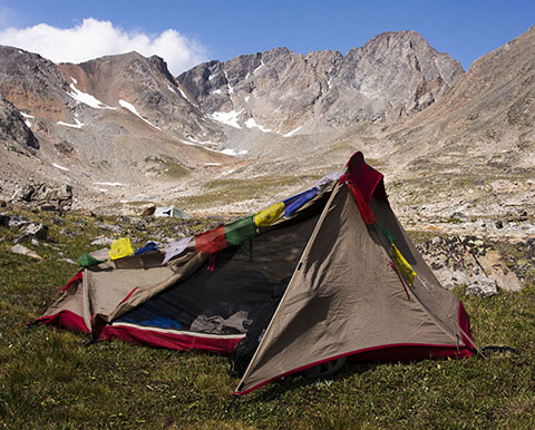
As the day wore on, the storms dissipated and by late afternoon, the skies started clearing over the mountains. My MSR Zoid tent held up to stiff winds and blowing rain and kept Jim and me dry through the day. I did find a couple of spots on the rain fly that needed a dab of seam sealer when I returned home but they just dripped onto the poles and the drips ran down outside the body of the tent so we were dry inside. The prayer flags were an acquisition in Katmandu, Nepal, on a non=climbing trip. They come along with me regularly now. We set alarms and settled in for the night. |
|
Sunday, August 7, 2016 |
|
When we awoke on Sunday, there were a few light puffs illuminated by the early morning light. We decided that this was our opportunity to try for the summit, so we loaded up day packs and hiked up to the base of the peak. By the time we got there, clouds were gathering and looking more threatening. We started up the talus leading up to the Southwest Ramp.
|
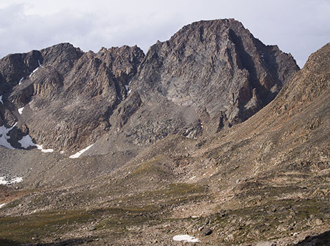
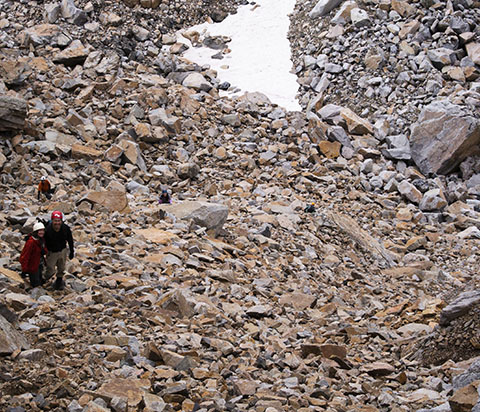
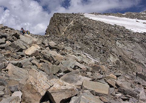
Most of us scrambled up the lower part of the talus toward the SW Ramp. The clouds continued to build, looking to turn into storms sooner rather than later. Denis and Lizzy, our younger and faster climbers, decided to make a dash for the summit. The rest of us opted to return to camp rather than risk being exposed up high should the threatened storms develop. Looking out over the valley, the skies looked to be steadily closing in. As is evident from the rocks in the foreground, this is a rough, rocky route to scramble up. |
|
|
|
We returned to camp to wait out the weather. There were occasional peals of thunder from the surrounding peaks, which made us feel better about having abandoned the climb. We settled in and waited for Denis and Lizzie to return. They came back in the afternoon with a rather harrowing tale of having made the summit but then being pinned down by a thunderstorm, seeking shelter under a rock overhang. We congratulated them on their successful summit and were thankful they made it up and down safely. One more night in the mountains, then it would be time to head back to civilization. |
|
Monday, August 8, 2016 |
|
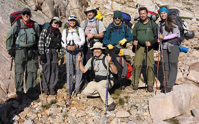
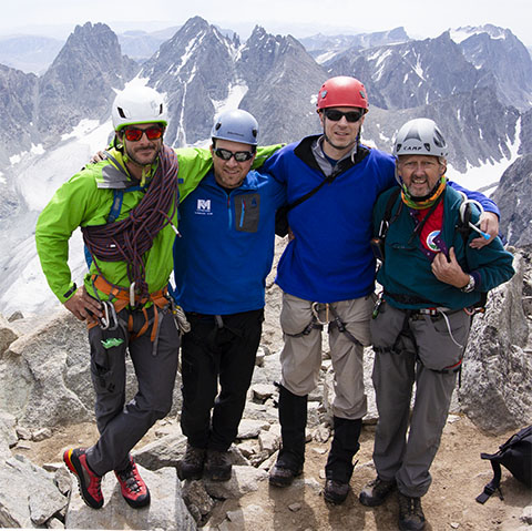
Even with the mountains shrouded in pre-dawn shadows, clouds were already building over Granite Peak. We packed up camp and headed back down the valley. As the sun rose, we stopped for a group photo. Left to right, Jim Sutton, Kathy Dalsaso, Lizzie Brammer, Denis Dean, John Mitchler (kneeling), Alan Ritter, Tim Webb, Whitney Webb. |
|
|
|
|
Shortly after our group photo, Jim began to have some difficulties. At first, he thought it was just shortness of breath but after talking to another highpointer we met on the trail (who, fortunately, turned out to be a physician), we became concerned that it could be heart-related. Fortunately, Denis had a "Spot" personal locator device with him, so we found an open area a couple of hundred yards further down the valley where a helicopter could land and Denis pressed the "SOS" button on his Spot. We brought Jim's pack up to the landing zone and improvised a wind sock out of tent poles and gear to give the helicopter pilot an indication of conditions on the ground. The Spot sends out a signal but does not receive replies, so we stayed with Jim, planning on waiting for the helicopter. After an hour with no sign of impending rescue, we decided to split up and most of us would head down to the cars where we could drive into Cooke City and determine how to extract Jim. Fortunately, after an aspirin and some rest, Jim's condition seemed stable, so we left Lizzie with him and the rest of us started down. As we passed Rough Lake, we heard the sound of a helicopter and saw it circle and land behind the ridge, so we knew that help was there. We waited a while after the chopper took off for Lizzie to catch up with us but she didn't come over the ridge so we continued on our way out. |
|
|
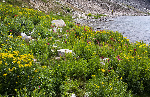
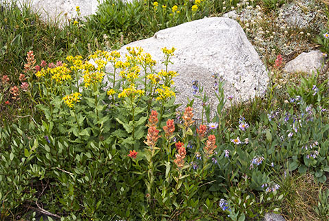
Having seen the chopper headed back toward Cooke City, we could relax a little and smell the wildflowers along the trail. As we hiked, we heard more helicopter activity back toward Granite Peak. We would find out later that a young climber had fallen and lost his life, confirming that Granite Peak is not a mountain to be trifled with. About a mile before we reached the trailhead, Lizzie approached us coming up the trail. She had been taken back to Cooke City on the chopper with Jim and reported that he had been taken by ambulance to the hospital in Cody, WY, for further evaluation. It turns out that it was a good thing Denis had his Spot, as Jim was transferred from Cody to Billings, MT, and ended up with triple bypass surgery that week. From Cooke City, we headed up to Red Lodge, Montana, for the annual Highpointers Club Konvention. |
|
|
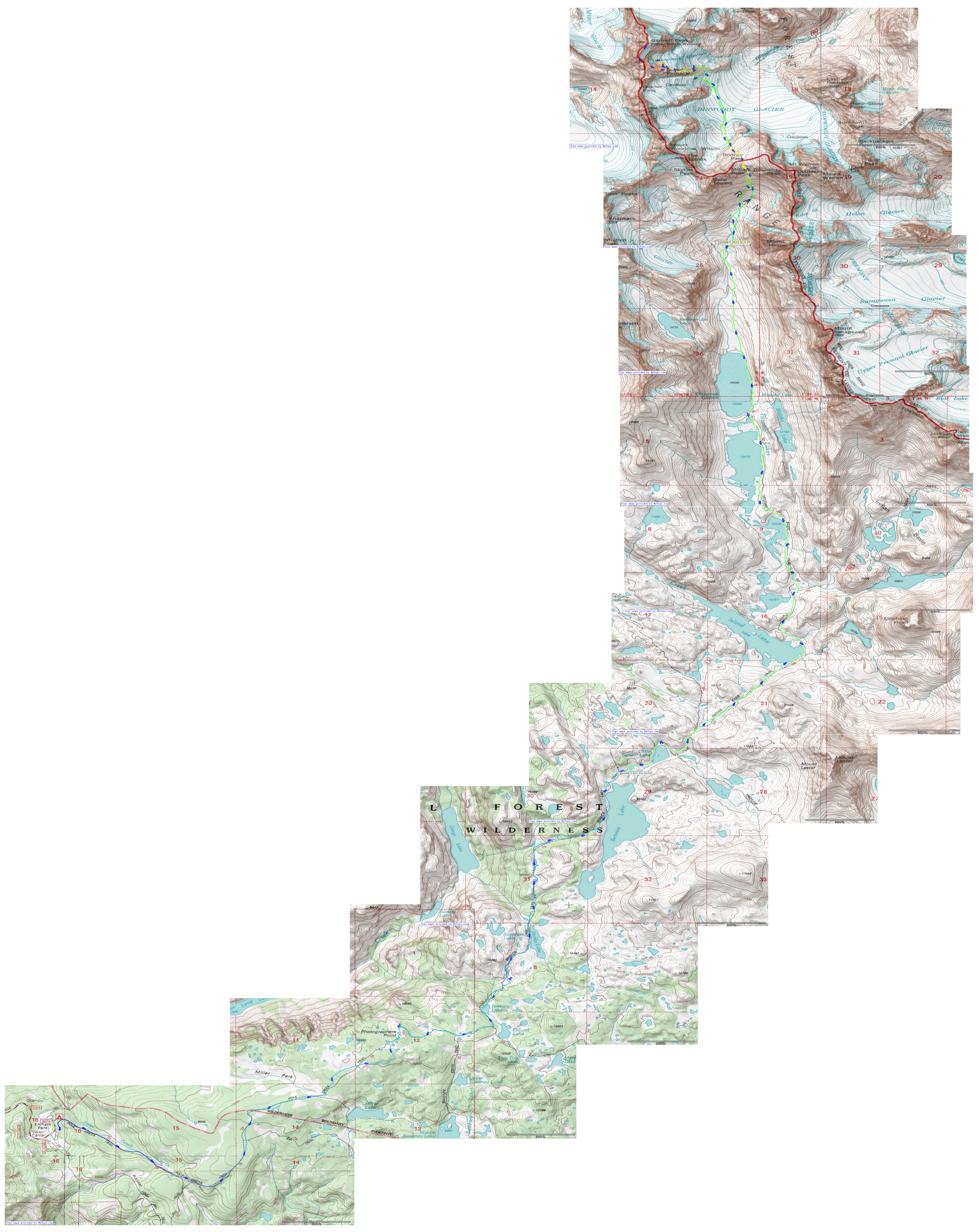
The map shows our journey from the trailhead as far as our high camp and the point on the climb at which most of us turned around. The link will take you to a full-size copy of the track, a 10-megabyte image file. The maps were generated with Topofusion software. It is not free but reasonably-priced. The track is color-coded, with the lower (trailhead) elevation in blue, moving through the spectrum to red at the highest point we reached before turning around. The narrative will pause here for a few days during the Highpointers Club Konvention in Red Lodge, MT. |
|
Gannett Peak, Wyoming |
|
Sunday - Monday, August 14 - 15, 2016 |
|
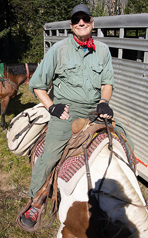
After the Club Konvention ended on Sunday, I drove to Jackson Hole, Wyoming, to meet up with the guides and climbers for our attempt on Gannett Peak. We did a gear shake-down on Sunday and drove up to the trailhead at Elkhart Park on Monday. There, we handed off most of our gear to the horse packer who would haul it up to our first camp. With light packs, we made good time and met up with the horse packer at camp near Island Lake. We settled in and enjoyed the quiet of the mountains. |
|
|
Tuesday, August 16, 2016 |
|
|
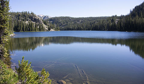
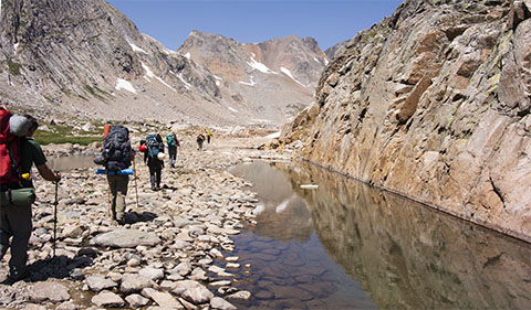
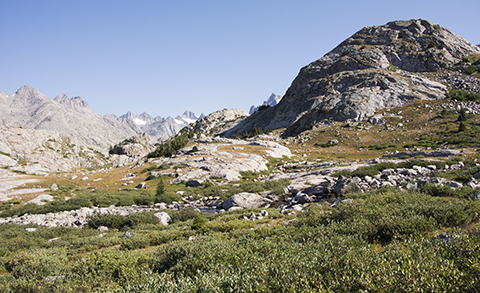
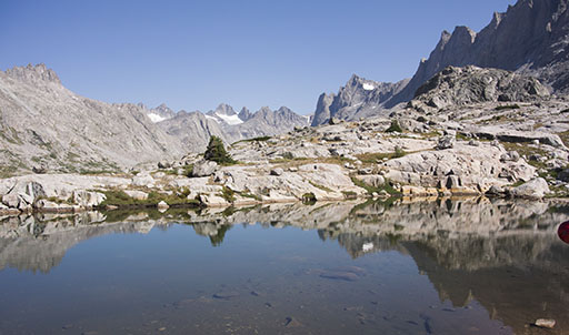
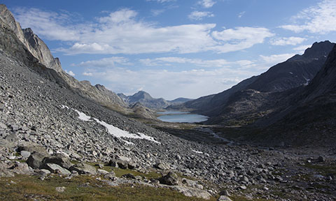
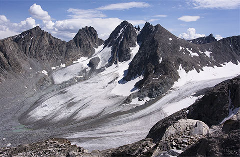
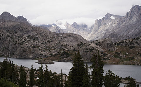
The second day's hike brought us up the Titcomb Basin to our high camp at about 10,800'. Along the way, the secenery is spectacular, passing the series of Titcomb Lakes and other smaller tarns. |
|
|
|
|
Arriving at camp, we had a great view back down the Titcomb Basin. Turning around, we could see Bonney Pass ahead of us. We enjoyed dinner and settled down early so we could get up at 1:00 a.m. (!) the next morning to begin our summit day. |
|
|
Wednesday, August 17, 2016 |
|
The "morning" arrived all too soon. A quick breakfast and we headed toward Bonney Pass
by headlamps at 2:00 a.m. It is a steep and rocky scramble up to Bonney Pass at 12,800'. That
is followed by an equally steep and rocky scramble down to the Dinwoody Glacier.
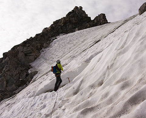
We donned crampons and roped up to head out on the glacier. Crossing the glacier proved
less threatening than anticipated as the few crevasses we encountered were narrow and easily
avoided. By the time we reached the north side of the glacier and were back on rock for
a while, the sun was brightening the skies.
|
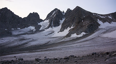
A brief scramble across the rocks brought us to the base of the Gooseneck Glacier. Sunlight began to illuminate the Dinwoody Glacier behind us as we approached the one steep pitch up a tongue of the Gooseneck Glacier that would take us to the final scramble along the ridge to the summit. |
|
|
As we geared back up for the Gooseneck Glacier, Eddie scouted out the bergschrund (open and deep) and the snow bridge across it (reasonably solid). In mid-morning, the snow was firm and gave good purchase for our crampons. Eddie belayed us up two pitches of snow until we moved onto the rock to the right of the glacier.
|
|
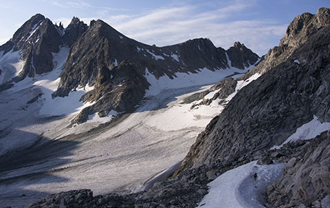
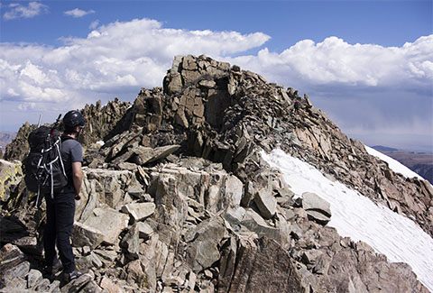
From the top of this tongue of the Gooseneck Glacier, you can get a sense of the steepness of the snow we had just climbed. Turning around, we could see the summit ridge. From the top of the snow up to the ridge is a mixture of steep second-class and moderate third-class climbing. The rock is solid and holds are plentiful so we made good time up to the ridge.
|
|
|
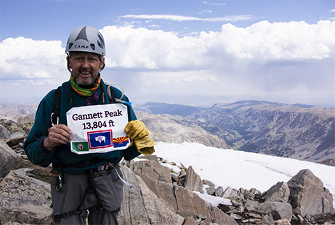
Nearing the summit, there is a bit of a step up to the summit, proper. There were plenty of holds and I scrambled to the top of the state of Wyoming. |
Heading up the boulder scramble, you get a sense of what is to come. The ridge is steep on the east side but once you get to it, you realize that the west side is basically vertical. On the way up, a group of climbers was a little ahead of us. They stayed higher on the ridge, on rock the whole way and I followed their route. Eddie and the rest of our group stayed a bit lower and found themselves having to cross a patch of steep snow with a cliff at the bottom edge, so Eddie belayed the others across.
|
|
|
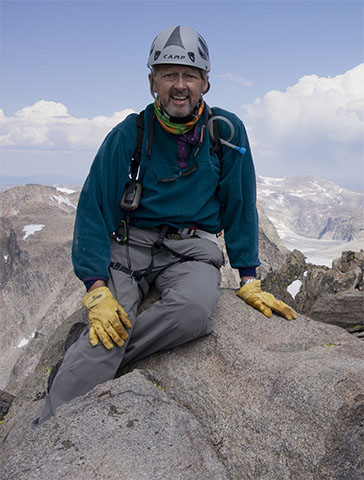
Time for summit photos! First, seated on top of the summit rock, then another solo shot and a group shot of the team. The weather cooperated nicely on the way up but clouds were starting to build by 1:00 p.m. and we reminded ourselves that "the summit is only halfway." We had a long way and a lot of down and up to do before getting back to camp. |
|
|
|
|
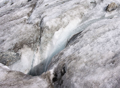
On the way down along the ridge, we all stuck to the rock, or the gutter between the rock and the top of the summit ridge snowfields, so we made good time. The snow had softened during the day, so Eddie's belay down to and over the snow bridge across the bergschrund was appreciated. From the Gooseneck Glacier, we could look back across at the summit ridge and see where we had been a couple of hours before. You can definitely tell this is a mountain, not a hill! Looking south, we could see Bonney Pass across the Dinwoody Glacier. Our return would backtrack along the same route we had taken early in the morning, taking us down to 11,500' and back up to Bonney Pass at 12,800'. As we crossed the Dinwoody Glacier, we stepped over several rivulets of meltwater that coursed down the glacier until they found an opening into a crevasse and disappeared from view. |
|
|
|
|
|
We reached Bonney Pass about 6:45 p.m. We could look back to the northwest and see Gannett Peak through the early evening haze and look southeast and see the Titcomb Basin where we knew camp was waiting for us.
|
It was still a long slog down from Bonney Pass and a mile or so of easier walking back to camp. By the time we reached camp, it was after 8 p.m., making an 18-hour summit day. Dinner was prepared in short order and we didn't dally before settling down for the night. |
|
Thursday, August 18, 2016 |
|
We slept in a little later this morning, packed up camp and headed back down toward civilization, knowing it would be two days getting there. Looking across the valley from camp, the terminal moraine from the glacier that carved the upper part of this valley was clearly defined. Meltwater from the remnants of the glacier drained across the moraine and had provided a lullaby of cascading sound the night before.
|
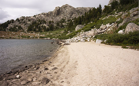
The hike back down the Titcomb Basin went smoothly, passing wildflowers and tarns along the way. The shores of one of the small lakes was more reminiscent of the Caribbean than the Wind River range, with a beach of white quartz sand ground out of the surrounding rocks by glaciers and water. I suspect that a dip in that lake would have been a bit brisk compared to the Caribbean, though! |
|
|
|
|
Looking back up Titcomb Basin, clouds were brewing over Bonney Pass and Gannett Peak, so we had definitely picked the better weather day for our summit attempt. We paused briefly at our first night's campsite to retrieve food cached there for our return. We made the turn to the southwext and picked up the Indian Pass trail. We stopped for the night at a small lake between Little Seneca and Seneca Lakes.
|
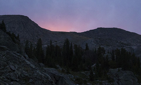
The last glow of sunset turned the high clouds pink as we settled down for our last night on the trail. |
|
Friday, August 19, 2016 |
|
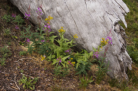
The sun rose over our little lake the next morning, promising a good final day's hike out. We packed up and headed toward the trailhead some ten miles away. There were more wildflowers among the logs along the trail.
|
|
|
|
According to my GPS, we covered 47.9 miles in five days. The summit day was about ten-and-a-half miles and covered 11,200' of gross elevation change. The GPS track shows our route. The image to the left links to a full-size version of the file, more than 5,000 x 6,500 pixels, about 25 megabytes. As noted above, the maps were generated with Topofusion software. Three days of driving back home to St. Louis, with the traditional stop near Kimball, Nebraska to revisit Panorama Point, the Nebraska highpoint and the Colorado/Wyoming/Nebraska tripoint. Once again, 50/50 for the trip with the storms on Granite Peak but a successful summit of the highpoint with the longest approach and one of the toughest summit days, Gannett Peak. That brought my total to 46 state summits. |
|
Respectfully submitted by
Alan Ritter, August, 2020 |