|
Finishing the Lower 48
|
|
Tuesday - Friday, July 13 - 16, 2021 |

|
With Scouting commitments in 2019 and the cancellation of the Highpointers
Club Konvention due to Covid in 2020, I had delayed my trip out to Nevada.
Although the Konvention was once again canceled in 2021, I decided to make the
trek west anyway to climb Boundary Peak and claim my status in the "Forty-Nine
Forever" subset of 48-state finishers. I arranged to meet our son, Nathan, in Reno, Nevada,
on July 16, so pointed the Outback west on July 13.
The route out as far as Salt Lake City is a very familiar one, I-70 west to Kansas City,
I-39 north into Nebraska and then I-80 across Nebraska (with the requisite stop at
Panorama Point, the Nebraska highpoint), through Wyoming and on into Utah.
Staying on I-80, I crossed Utah and Nevada and met up with Nathan on Friday afternoon.
We then headed south on Highway 395 to Mammoth Lakes, California, as our base of operations for
this trip.
|
|
Saturday, July 17, 2021 |
|
We did a bit of online research for trails near Mammoth that would give us a few miles of hiking and take us up at least to 10,000' to acclimate to altitude. Since we both live below 1,000', we have learned to spend at least a couple of nights at intermediate altitudes with a day-hike in between before heading up for real. |
|
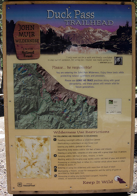
Duck Pass Trailhead Sign |
We opted for the Duck Pass Trail a few minutes outside of Mammoth Lakes. We could
choose our distance based on our turnaround and have some interesting scenery past
a couple of lakes as we headed uphill.
The trail starts out close to 9,000', climbing fairly steeply at first and then leveling
out a bit as it follows a valley up past Arrowhead Lake and Skelton Lake. Once we reached
Barney Lake at about 10,200', we opted not to continue over the pass to Duck Lake, proper,
having gained a bit over 1,000' in 2-1/2 miles. We took a few photos and headed back down.
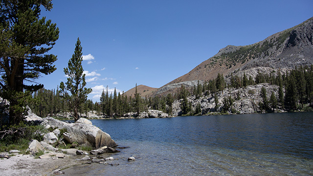
On the way down, we stopped at a small beach by Skelton Lake and watched some other hikers'
dog enjoying himself splashing in the water. It was a nice way to spend a few hours and
get our heart rates up in preparation for Boundary Peak.
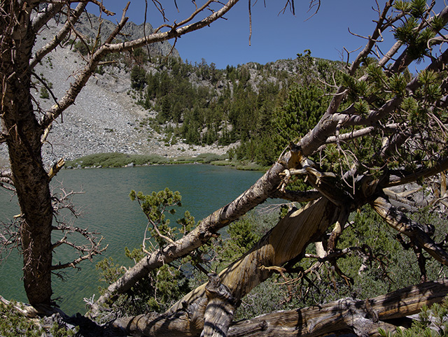
Barney Lake through the Trees
|
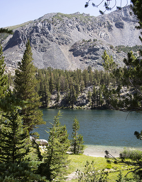
Skelton Lake |
For a look at our warmup hike, here is the GPX track overlaid on the topographic map. Note that this map has elevations in metric, not English units.
Beach on Skelton Lake |
|
Returning to the car, we drove up to the Minaret Summit area to take a look at "our" mountain, which we planned to climb after Boundary Peak. After a fairly low snow year and a very warm beginning to the summer, even the upper snowfield on Mt. Ritter was but a shadow of its usual self. We stopped back at the Mammoth Mountain ski resort for lunch before heading back to the motel to pack up for Boundary Peak the next day. |
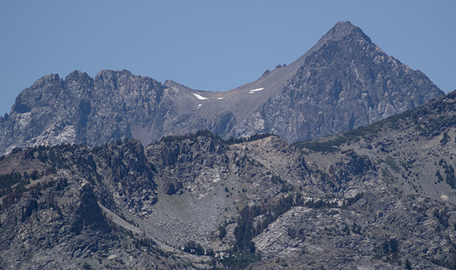
Mt. Ritter from Minaret Summit |
|
|
Sunday, July 18, 2021 |
|
Knowing we had a short hike up to our planned camp at the Kennedy Point saddle,
we slept in a bit and enjoyed a leisurely breakfast. We rearranged things in
the car to hide everything under the cover between the rear seat and hatch. We
drove across the Benton Crossing Road to pick up Highway 6 into Nevada. Turning
right onto the Queen Canyon Road, we headed up toward our destination for the night.
The road has not seen much, if any, maintenance in the past 20 years and after the
first half-mile or so, is washed out and rutted. The willows a bit farther up were
not as overgrown as in the past and it was easy to avoid scratching the paint with
only a few spots where biasing to one side to avoid the worst of the ruts caused
them to brush the side of the car.
We found a convenient turnout before the road deteriorated to the point that I
worried about clearance even with the Outback and parked the car for the day. We
enjoyed our lunch leftovers from the Yodler the day before, shouldered our packs
and headed up to Kennedy Point.
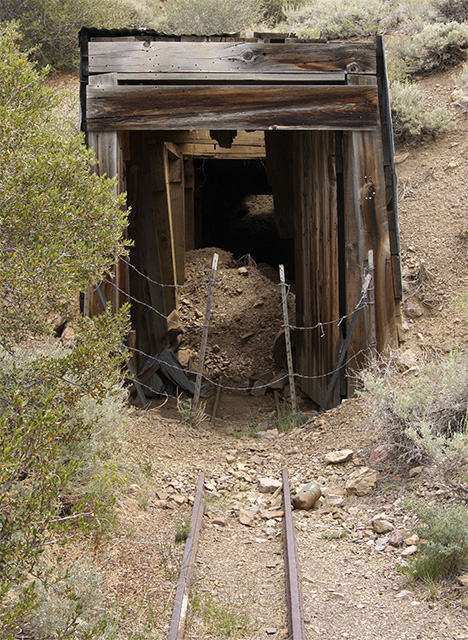
Hiking up to our camp, we passed several abandoned mines in various stages of
collapse. I noted the spot I had planned on parking but observed to Nathan
that the "road" between where we parked and that spot would have been iffy, at best,
to traverse with the Outback. Not to worry, we got an extra mile or so of exercise
in the process.
|
Abandoned Mine along the Queen Canyon Road |
|
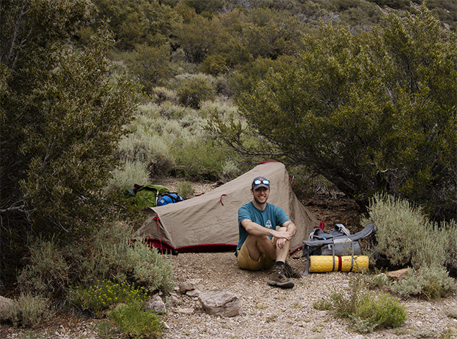
Sheltered Campsite at Kennedy Point Saddle |
We arrived at the Kennedy Point saddle in due course. Up there, at about 9,800',
the wind was blowing across the saddle and we were happy for the brushy growth
providing some shelter for our campsite. We set up the tent and arranged things
for the night. A few brief showers blew through, just enough to make it worthwhile
to stay in the protection of the tent until dinnertime.
We prepared a freeze-dried dinner and scouted the trail up the adjoining ridge that
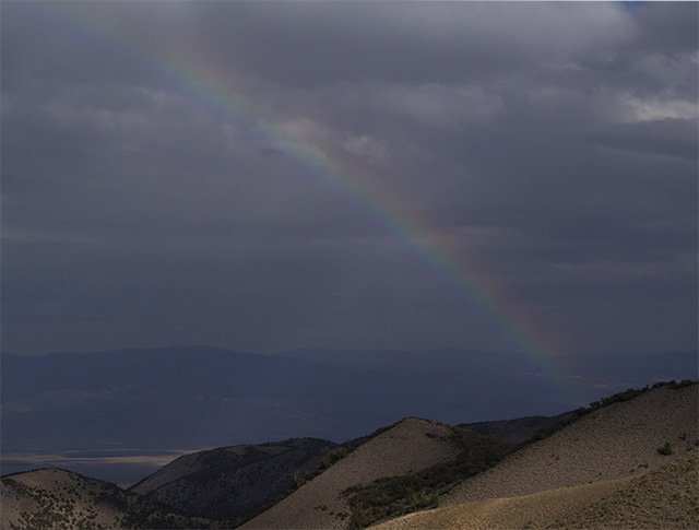
we would follow the next morning. As the sun set, we were treated to a brief rainbow
across the valley to the east of Kennedy Point.
|
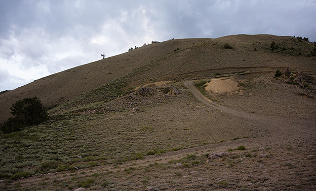
Trail up the Ridge South from Kennedy Point Saddle Looking across the saddle from our campsite, the trail follows the Jeep trail up and across a mine claim cut. It then turns to a footpath above the cut and trends to the right up toward the top of the adjoining ridge. |
Rainbow over the Valley East of Kennedy Point |
|
Monday, July 19, 2021 |
|
When I woke up about 5:30, it was drizzling a little, so we stayed in
the tent until it stopped. Although cloudy, there didn't seem to be any
threat of thunderstorms, so we ate a quick breakfast, shouldered our day
packs and headed up the ridge. As we topped out on the first steep stretch
of trail, we could look back to Kennedy Point and see our camp in the saddle
below.
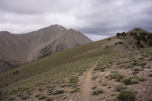
Looking forward along the Ridge toward Boundary Peak
|

Looking back at our Camp from the Ridge
The trail continues uphill at a mostly-moderate rate, contouring along the
ridge between Kennedy Point and Trail Canyon. Although the view from the ridge
past Trail Canyon Saddle looks like there is quite a bit of drop, this is a trick
of perspective and there is very little "down" to lose and have to re-gain along
the way.
|
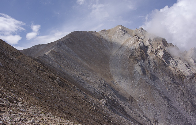
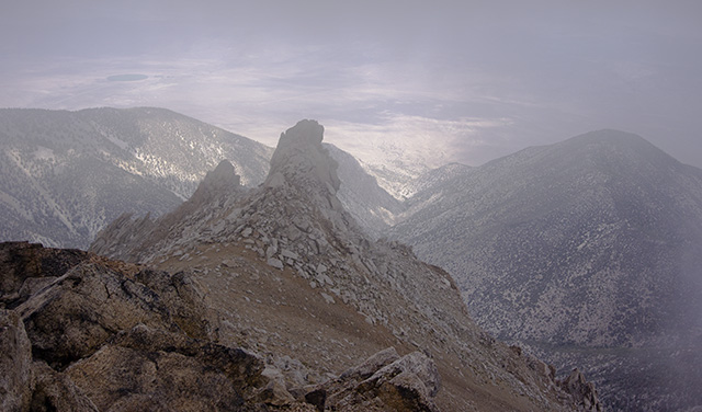
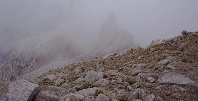
The View from Trail Canyon Saddle toward Boundary Peak Once we passed the second saddle, the we could see the rest of the ridge up to the summit. At this point, the trail deteriorates into a series of braided use trails meandering among the rocks and scree. At points, it is a "two steps forward, one step back" process that gets to be very frustrating. There was no clear "best" path through this stretch, so we took turns finding a marginally better path and letting the other catch up. |
From the Trail Canyon Saddle, the view shows how steep and rocky the rest of the climb will be.
There is a second saddle around the near ridge and the trail continues to contour upward through
increasingly annoying scree and rock slabs. Clouds were intermittently blowing in over the summit
but still nothing threatening, so we continued.
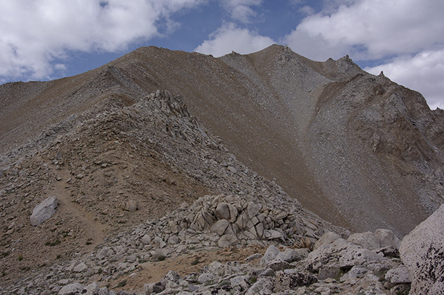
The Final Stretch up to the Summit of Boundary Peak
|
|
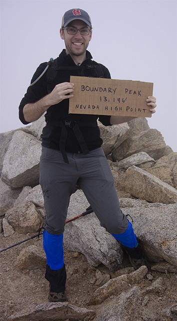
Nathan was a bit ahead of me on the final ridge. The clouds closed in briefly as I
took his photo at the top of Nevada. I joined him shortly thereafter, bringing to
a conclusion a 26-year oddyssey to finish the highpoints of the lower 48 states. Boundary
Peak had taken us just shy of 5 hours from camp to summit, quite a bit slower than
I would have estimated based on distance and altitude gained. Its reputation as a scree
slog is well-deserved and that sort of gravelly climbing slowed us down.
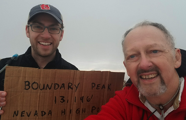
Summit Selfie on Boundary Peak
|
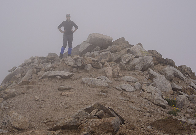
Nathan on the Summit of Boundary Peak
It being the 21st Century, we naturally took a summit selfie to post as soon as we
had decent cell coverage. We signed the summit log book, noting Boundary was my 49th
highpoint and the completion of the lower 48. Nathan now has 42, so he has some catching
up to do.
|
|
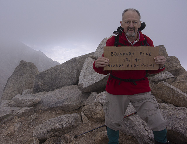
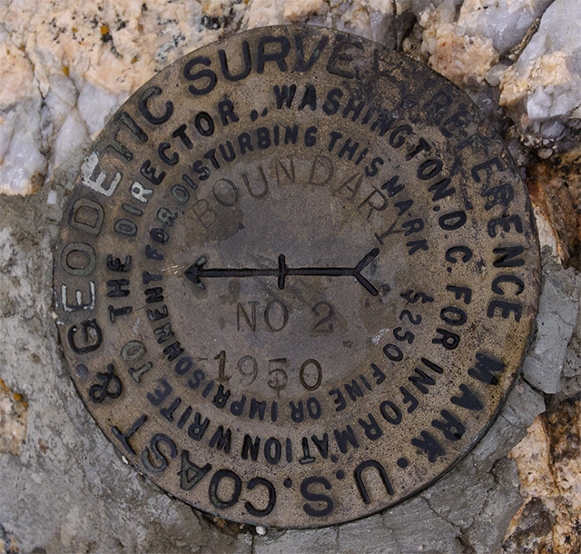
With no one else in sight, we shared summit photo duties to document our success at reaching
Nevada's highest point. We looked around the summit area and found a benchmark plus another
reference mark. There isn't a sign, save the handwritten cardboard one someone thoughtfully
left in the ammo box with the summit log book.
Alan Finishes the Lower 48 atop Boundary Peak
|
Nathan Improves his Highpoint Total to 42 atop Boundary Peak |
|
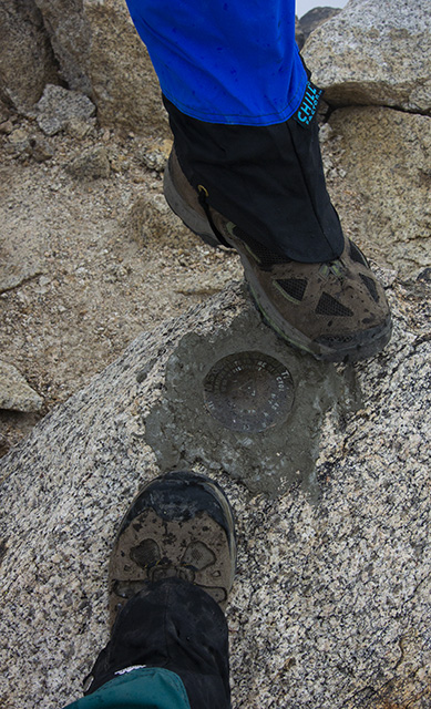
Summit Benchmark with Boots |
The summit benchmark is pretty worn and hard to read, so we just took a photo with our boots for reference. You noticed that we wore gaiters? They're highly recommended if you want to keep the gravel out of your boots on Boundary Peak. It was worth the extra few ounces each that we carried in order not to have to stop and empty our boots of scree. The nearby reference mark is in better condition.
Reference Mark in the Summit Area |
|
View from the Summit into the Valley and Highway 6 |
A couple more summit view shots and it was time to head back to camp. Thundershowers were forecast for the afternoon and we felt fortunate that the weather had held this well so far.
View from the Summit back along the Ridge |
|
Having successfully reached the summit of Boundary Peak, it was time to head back to camp.
I've often said that "the summit is only halfway" and Boundary Peak was about to demonstrate
that in spades. Not long after leaving the summit and well before we reached any semblance
of a trail, I hit a patch of ball-bearing scree on a flat rock. I spun, tucked and fell onto
my back on top of my summit pack. Something hard in the pack ended up between my back and the
rock. Ouch. Since both Nathan and I have been trained in wilderness first aid over the years,
we did a careful inventory. No damage to limbs. That's good. A little scrape on one knuckle
from the rock. That'll heal. But...where I landed on my back, I could tell I had cracked a rib.
No difficulty breathing but moving my right arm caused significant pain in my ribcage. Nathan
asked if he needed to call in help (we did have some cell coverage at that spot), but I declined.
As long as I was careful not to move my right side too much, I could walk without much discomfort.
Having cracked a rib in a skiing incident several decades ago, I was pretty sure of the general
extent of my injury and wasn't worried about walking back to camp and then to the car.
As we headed down, we began to hear thunder out in the valley to our left. Fortunately, it was
a good distance away and the clouds were moving away from us, so we continued down from the peak.
We took a break at the Trail Canyon saddle. From there, the quality of the trail improved significantly
so we made more or less decent time back to camp. As we arrived, the rain began and shortly became
quite heavy. I wasn't of much use at that point, so Nathan had to break camp and pack things into
our two main packs. We were both glad our campsite was well below the ridgeline as there were
lightning strikes on both ridges above us as Nathan packed up camp.
When we first started our backpacking and highpointing escapades, I ended up carrying most of the
weight and Nathan had a small pack suited to his stature of the era. He has now officially paid
that back, with interest, as he carried his pack down to the car on the first trip, then made the
five-mile round-trip to camp and back to the car to carry the rest of our gear down. I knew I had
raised a useful pack horse for a reason!
When we got back to Mammoth Lakes, a visit to the ER there confirmed the field diagnosis (and then some).
I had broken not one, but two, ribs. No wonder it hurt. The ER physician said they'd usually have kept
me overnight for observation but since I was with Nathan, she trusted him to monitor me and get me back to
the ER if anything changed for the worse. She also insisted that I come back for follow-up x-rays in
the morning to verify that the breaks had not dislocated and I wasn't at risk of pneumothorax. A pizza,
a couple of beers and 3 Ibuprofen later, I tried (with mixed success) to sleep.
The second set of x-rays showed both breaks well aligned so the ER physician said it was ok to head for
home. Nathan offered to drive back with me instead of flying from Reno back to Chicago and I took him
up on his offer. Mt. Ritter and my tour of Arches and Canyonlands in Utah will have to wait for another trip.
The trip home was uneventful, although we had to detour through the southern part of Colorado due to
mudslides on I-70 and construction on U.S. Highway 50.
|
|
References |
|
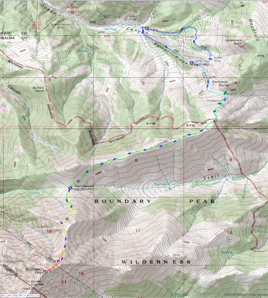
The map below is an overview of our route up Boundary Peak. A larger copy of that map plus
a zoomed-out view showing the Queen Canyon Road in from U.S. Highway 6 and another of our warmup hike
outside of Mammoth Lakes are also available here. I've included links to the GPX track and waypoint
files, as well. Those won't display nicely in a browser, so just use the links to download the
files either for your GPS or to load into your favorite GPX mapping software.
I've used Topofusion software to generate these maps.
The free version is ok to play with but obscures pieces of the map. The full version isn't
terribly expensive and seems to work quite well with the track and waypoint data out of my
Garmin Oregon 450 GPS.
|
|
Respectfully submitted by
Alan Ritter, August, 2021 |