|
Fourth Time is the Charm:
|
|
Wednesday - Thursday, August 6-7, 2014 |

|
Last year, we were successful on Borah Peak (Idaho) but got stormed off Kings without even a summit attempt. This year, I teamed up with fellow highpointers Ed Erickson from Wisconsin and Dorothy Kucar from New York. Ed was already in Salt Lake City to visit his daughter, so I flew out a day early to meet up with him and get some exercise at intermediate altitudes before heading up to Kings. The photos below link to pages with larger copies of the photos if you wish to see more detail in any of them. |
|
|
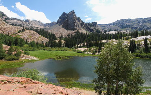
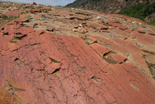
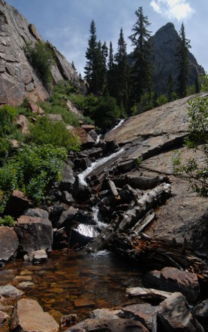
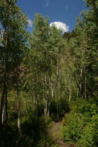
The rocks by Lake Blanche show significant glacial polish and scoring from the stones that were carried down by the glaciers, testifying to the origins of the canyon system northeast of Salt Lake City. After getting to the lake, we paused a while for a snack and water break. Then, we walked a bit upstream to where the inlet stream passes over a nice waterfall before flowing into Lake Blanche. On the way down, the aspens looked crisp in the dappled sunlight. This would certainly be a nice hike in the early fall when the aspens turn to gold. After our hike, Ed and I did a little shopping at REI, grabbed some dinner and drove out to the shore of the Great Salt Lake before heading back to the "park and wait" lot at SLC to wait for Dorothy's flight to land. After picking her up, we headed up to Evanston, WY, for the night. |
|
|
|
|
|
Friday, August 8, 2014 |
|
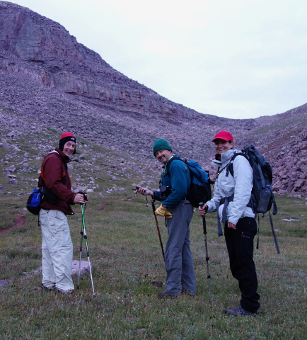
Two of Dorothy's friends from New York, Michael and Anna Simon, met us at the motel. We drove east on I-80 to Fort Bridger and then down to Mountain View. We knew this time to ignore my Garmin GPS which thinks it knows a better way to the Henrys Fork campground and turned right at the bronze elk statue in downtown Mountain View. From there, we meandered down the Forest Service roads to the Henrys Fork campground and trailhead. Google Maps, by the way, does know the right way, so trust it rather than Garmin's road routing. |
|
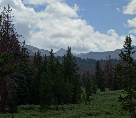
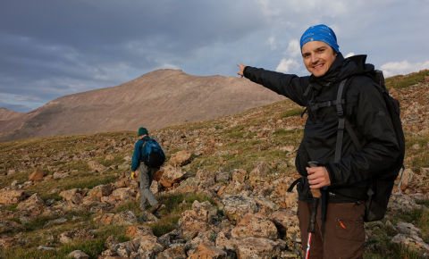
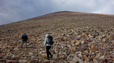
The Henrys Fork campground includes both an equestrian area and general camping area. The backpackers' trailhead is at the farthest parking lot, so drive past the equestrian area to reach the trailhead. (Waypoint HENRYS FORK, 40°54.548'N, 110°19.872'W) Once you leave the trailhead, your first landmark will be in about two miles, the trail off to the right that leads up to Alligator Lake. (Waypoint ALLIGATOR JCT, 40°53.227'N, 110°21.567'W) The trail takes off immediately after the short footbridge spanning the outflow stream from Alligator Lake. Not being a trained geologist, the following interpretation is subject to more learned judgement but shortly after the trail to Alligator Lake, you will pass what appears to me to be the first of two lateral moraines left by the glaciers that carved this valley system. (Waypoint MORAINE 1, 40°53.165'N, 110°27.718'W) The second moraine is a bit farther up the trail and much more pronounced. (Waypoint MORAINE 2, 40°51.954'N, 110°22.800'W) Shortly before we reached Elkhorn Crossing, we could catch our first glimpse of Kings Peak across the meadows and over an intervening ridge. Kings Peak is the prominent peak between the two spruce trees in the center of this photo. From this vantage point, you can't yet see Anderson Pass in front of Kings and our intended campsite just short of Gunsight Pass is off to the left behind the intervening ridges. Still, seeing the goal of the trip provides inspiration to continue up the trail and up the hill. |
Photo courtesy Michael Simon |
|
|
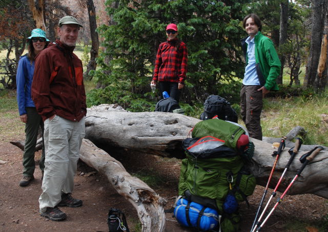
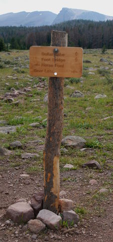
Near Elkhorn Crossing, (Waypoint ELKHORN XING,40°51.206'N, 110°23.030'W) there is a nice spot to stop for a break in a grove of trees just short of the crossing itself. We stopped there for some lunch and a bit of a rest after the first six miles or so of the trail. A signpost placed by the Highpointers Foundation shows the trails to the stock crossing, the bridge across Henrys Fork toward Dollar Lake and the trail to the right to Bear Lake. The footbridge is the one spot along the trail that requires a modicum of care. It is much better now than the first time Nathan and I tried Kings Peak back in 2004 (wow, has it been ten years already?) and the "bridge" was just three logs placed across the stream with only gravity holding them in place and no hand rope. |
|
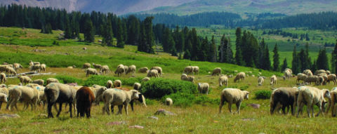
Photo courtesy Dorothy Kucar Since this area is Forest Service land, local ranchers bring their sheep up to graze on the summer growth. As we approached Dollar Lake, we came up to this herd of sheep meandering along and across the trail. The herders' camp was down in the valley and we could see the smoke curling up from their campfire. |
|
|
Photo courtesy Dorothy Kucar |
As we worked our way up the valley, we could see Kings Peak more clearly through Anderson Pass. Although it is possible to save some distance by crossing the valley and going up the slope to Anderson Pass, this route is generally discouraged because of the thousand-plus feet of slippery scree between the valley and the pass. No one I've talked to about it has anything but bad things to say about that variant, so the Gunsight Pass route, although longer, is strongly preferred as the approach to Kings Peak. |
|
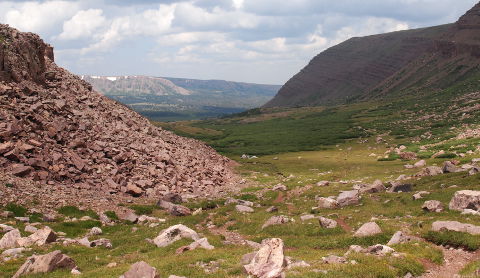
From there, we crossed the dreaded willow swamp, made much more tolerable now that the Friends of Kings Peak have installed boardwalks across the worst spots. By August, most of the swamp has dried out but before the boardwalks, it was a slow slog picking your way without stepping into knee-deep mud as the trails are cut deep and churned up by equestian traffic. It is just a short distance from the willow swamp to Dollar Lake, (Waypoint DOLLAR LAKE 2013,40°49.657'N, 110°22.829'W) where we had camped on our previous attempts. Dollar Lake is about 9 miles in from the Henrys Fork trailhead and has lots of nice spots to camp but we wanted to cut some miles and time off our summit day. Some of my highpointing buddies had recommended another small lake just off the trail and just below Gunsight Pass, so we continued along the trail after a short break at Dollar Lake. |
Photo courtesy Michael Simon |
|
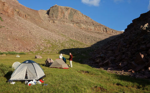
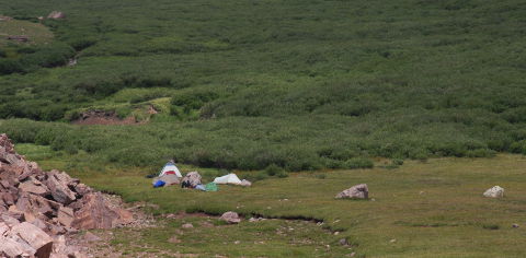
The two miles past Dollar Lake to our campsite proved to be a pretty long extension to the day, involving a fair amount more gain and crossing over a couple of low ridges that tried to fool us into believing we were closer to camp than we were. Ultimately, we were all happy to find the spot with a small stream nearby and the promised lake a couple of hundred yards downhill from where we chose to pitch our tents. (Waypoint GUNSIGHT CAMP, 40°48.102'N, 110°21.702W) Camp came together quickly and we were ready for dinner before sunset. |
|
|
Photo courtesy Michael Simon |
Photo courtesy Michael Simon |
|
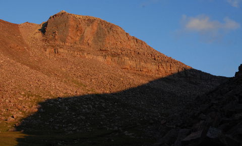
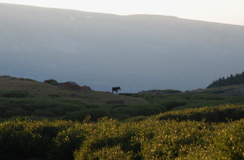
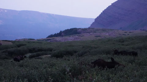
As the sun was setting and highlighting the red rocks next to our camp, a lone moose wandered along the ridge below the lake, creating a nice silhouette in the fading light. We settled in for the night, planning on an early start on the summit in case the weather started turning stormy in the afternoon. |
|
|
|
|
|
Saturday, August 9, 2014 |
|
My alarm went off at 5 a.m. A quick conference with Dorothy showed she was still suffering the effects of dehydration from the hike in the day before, so she opted not to make the summit push. Ed, Michael, Anna and I got up, ate breakfast and packed our day packs for the summit scramble. As the sun tinged the clouds various shades of coral and salmon, we were greeted by three moose browsing in the willows just below our campsite. We were far enough away from them and they were sufficiently acclimated to human presence that they took little heed of us as we got up and got moving. |
|
|
Photo courtesy Michael Simon |
|
Photo courtesy Michael Simon |
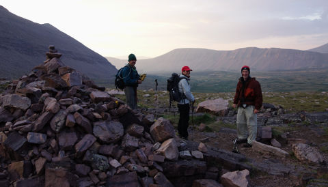
Bidding the moose (and Dorothy) goodbye, we started up the trail to Gunsight Pass. The trail that far is clear and easy to follow even in the early-morning twilight. One long quarter-mile switchback and we arrived at Gunsight Pass. (Waypoint GUNSIGHT PASS, 40°47.822'N, 110°21.568'W) The rising sun continued to tint the sky as we came over Gunsight Pass although the pass itself was still in deep shadow. We stopped just long enough to get our bearings and identify the trail we needed to take next. The main trail continues over Gunsight Pass and five hundred feet or more down into the Painter Basin. Unwilling to lose so much altitude, there is a better way. From Gunsight Pass, Kings Peak is hidden behind the ridge to the south. Immediately after passing the huge cairn at the pass, a good use trail takes off to the south (hiker's right). Following a series of cairns (or "ducks"), you stay level for a little while and then head up the rather steep ridge. |
|
|
Photo courtesy Michael Simon |
|
Photo courtesy Michael Simon |
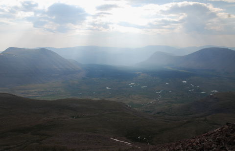
The ridge proved to be fairly steep and we gained more elevation than I had anticipated before the ground leveled out. When I looked at the topo map later, I realized that the area near Anderson Pass is quite a bit higher than Gunsight Pass so we weren't climbing only to have to lose elevation a little later. As we topped out on the ridge scramble, the vista over the Painter Basin opened up and we could see the small lakes in the basin glinting in the morning sun as it peeked through the clouds. We crossed over the ridge, down just a little bit and made our way across the plateau near Anderson Pass. |
|
|
|
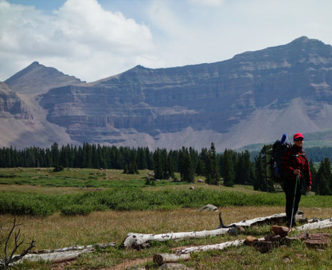
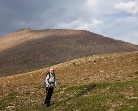
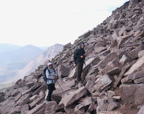
Michael and Anna paused long enough to take shots of each other with Kings Peak in the background. These views give a pretty good idea of the rockpile that is Kings Peak. From here, the ridge flattens out and we just contoured around it until we could see our way across the plateau and onto the slopes of Kings Peak, proper. |
|
|
Photo courtesy Michael Simon |
Photo courtesy Michael Simon |
|
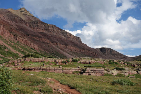
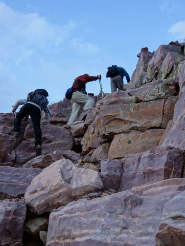
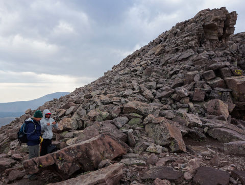
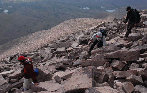
As we crossed the plateau next to Anderson Pass, I set another GPS waypoint. (Waypoint ANDERSON PASS, 40°45.139'N, 110°22.327'W) That is not at the pass, proper but out in the flat area just to the southeast of Anderson Pass. Did I mention that the final 1,500' of the climb up Kings Peak is a rockpile? An unrelentingly wretched rockpile, at that. Ed opted to cut farther to climber's right and found bits and pieces of a use trail along the lower parts of the ridge. I opted for a more direct diagonal roughly following my GPS bearing toward the summit. Michael and Anna joined me but we found the going slow. Either way, the going varies between rocky and rockier with only small patches of gravel and sand to break the monotony. As the broken clouds drifted by, we were treated to a few snow flurries as we headed up, but the weather remained unthreatening and even cleared (mostly) as we got higher on the mountain. Farther up, the slope steepens as is evident from the shot of Michael and Anna on the upper slope. Ultimately, we reached the ridge, just in time to have to contour around three false summits, the most prominent of which is shown on the right, below. This lump is the largest hump visible on the ridge as we hiked in and is every bit as obnoxious as it appears when you realize it's just another false summit to be skirted along the way. |
Photo courtesy Michael Simon |
|
|
Photo courtesy Michael Simon |
|
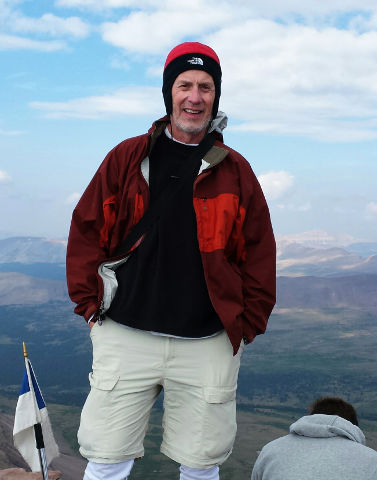
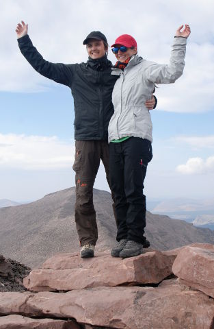
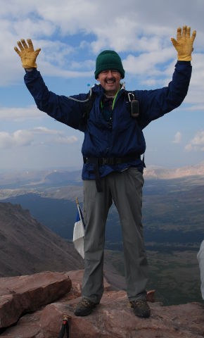
Having taken a slightly better line, Ed beat us to the summit by a few minutes, so he was waiting for us when we finally arrived. The summit area was fairly busy, with a group of guys celebrating their summit. It turns out they were dayhiking Kings Peak, having started at midnight and hiked through the night. According to my GPS odometer, trailhead to summit by the route we took was 14.2 miles, so they would be doing a 28-mile day with over 4,000' of gain (and loss on the way out). Not my idea of fun, but more power to them! The weather was chilly and breezy but tolerable. A fleece and wind shell were definitely called for to be comfortable. Kings Peak (Waypoint KINGS PEAK, 40°46.582'N, 110°22.378'W) was my 45th state highpoint and the one (so far) that took the most attempts to summit. I shot my traditional summit panorama, viewable either in a Java version or as a Quicktime VR file. The Java version allows full-screen display so you can use whatever display real estate you have available. |
||
|
Photo courtesy Ed Erickson |
|
|
|
Highpointers know that the summit is only halfway. We didn't tarry long on the summit because there were still enough clouds around that it was likely there would be some thunderstorms later in the afternoon. We made our way off the summit and headed back down to the plateau by Anderson Pass. Climbing back down the rockpile is only marginally more pleasant than climbing up, mostly from knowing there is a comfortable campsite waiting on the other side of Gunsight Pass. Eventually, the boulders give way to a gentler slope and finally to flat ground. At that point, we could breathe a little easier about the weather since we were now well below the ridges and in relatively sheltered territory most of the time. I remembered a slightly better way around the intervening ridge we had scrambled over earlier in the morning but the cairns I remembered were conspicuous by their absence. As you can see from the GPS track (below), we meandered down to the tops of the low cliffs before giving up and heading back up a bit and across the ridge to pick up our trail back to Gunsight Pass. In hindsight, backtracking the way we had come in the morning would have saved us a bit of down and back up but overall, it wasn't a huge issue. |
|
|
Once we got down off that long switchback coming back from Gunsight Pass, we could see camp ahead of us. Getting closer, it was all the more inviting in a grassy meadow above a large grove of willows. Dorothy greeted us with stories of moose visiting her during the day. She was in much better spirits although disappointed that she hadn't been able to make the summit with us. |
|
|
|
|
|
|
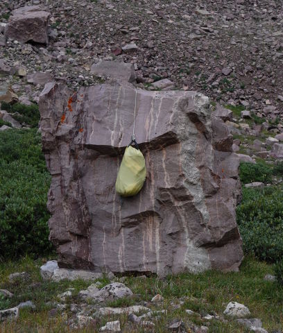
Since we were back at a reasonable time, Anna and Michael decided they would go ahead and pack up to hike out that afternoon. With limited vacation time and a plan to continue out west to California, they wanted to get back on the road. (They managed to get permits and climb Mt. Whitney on this trip, so it was worth the effort to keep heading west.) With no bears in this part of Utah, our "bear bag" hang only had to be high enough to keep the mini-bears (marmots, ground squirrels, etc.) away from our food. I had found a convenient rock the night before and strung my bear rope across the top so the bag was suspended shoulder-high off the ground. Ed pointed out that my bag formed the nose of a rather grumpy troll face on the rock so apparently the scare-marmot worked as we had no issue with critters getting into our food stash.
|
|
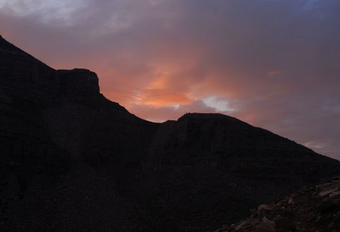
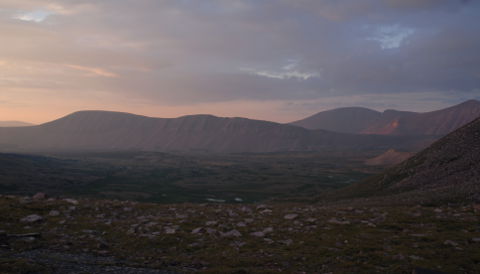
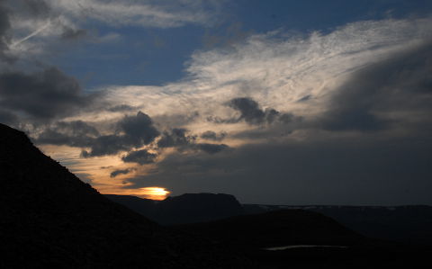
The expected afternoon thunderstorms finally rolled in but we were back in camp and snugly in our tents for the few that dropped any appreciable rain on us. They blew over for the most part and cleared in time for dinner and a nice sunset across the valley. We settled in fairly early, planning on being up and moving at a decent hour the next morning. |
|
|
Sunday, August 10, 2014 |
|
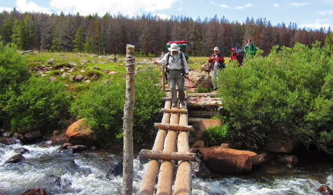
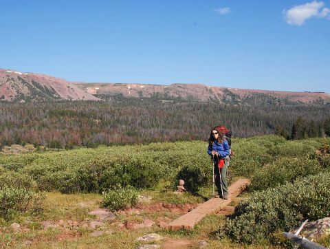
We were up and packing shortly after 6 a.m. and paused for breakfast at the far side of the grove of trees around Dollar Lake. When we got the the willow swamp, I asked Dorothy to pose for a shot showing one of the footbridges that have been placed across the worst of the mud. By that time in mid-morning, there were already small puffs of clouds as evident in the upper-right corner of this photo. We had definitely picked the right day for our summit bid. The morning continued pleasantly as we made our way back down the valley and across the bridge at Elkhorn Crossing. A group of Scouts were crossing just behind us and I made a point to remind them to unfasten their hip belts and sternum straps. Falling into even a foot or so of fast-moving water with a full pack can be deadly if you can't ditch the pack and it holds you under. |
|
|
|
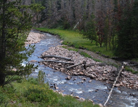
We stopped for a break at Elkhorn Crossing. The local greeting committee of mini-bears was out in full force and it took constant vigilance to keep them from attacking our packs. They still hadn't given up trying when we loaded up for the last stretch back to the Henrys Fork trailhead. I paused for one last photo of Henrys Fork below the trail a mile or so from the trailhead. With scenery like this through the whole valley, it is a worthwhile hike even if you aren't trying for the summit of Kings Peak.
|
|
After a few drops of rain in the last fifteen minutes of the hike, the thunder started in earnest back up the valley. We were happy to see the car and know that we were just an hour or so ride from the Pizza Hut in Mountain View, Wyoming. State highpoint number 45 checked off my list, number 44 for Ed. As we drove back up toward I-80 to head to Salt Lake City, the thunderstorms blossomed over the mountains behind us. It would definitely not have been a good day to be up there late in the afternoon. We dropped Dorothy off with her friends in Salt Lake. Ed and I headed up to a motel near the airport for the night since we were both flying back home the next day. All-in-all, a successful trip...with the bonus of having made the summit. (Any trip where you come home in the same number of pieces as you started is successful. Achieving the primary goal of the summit just adds to the pleasure.) |
|
|
References |
|
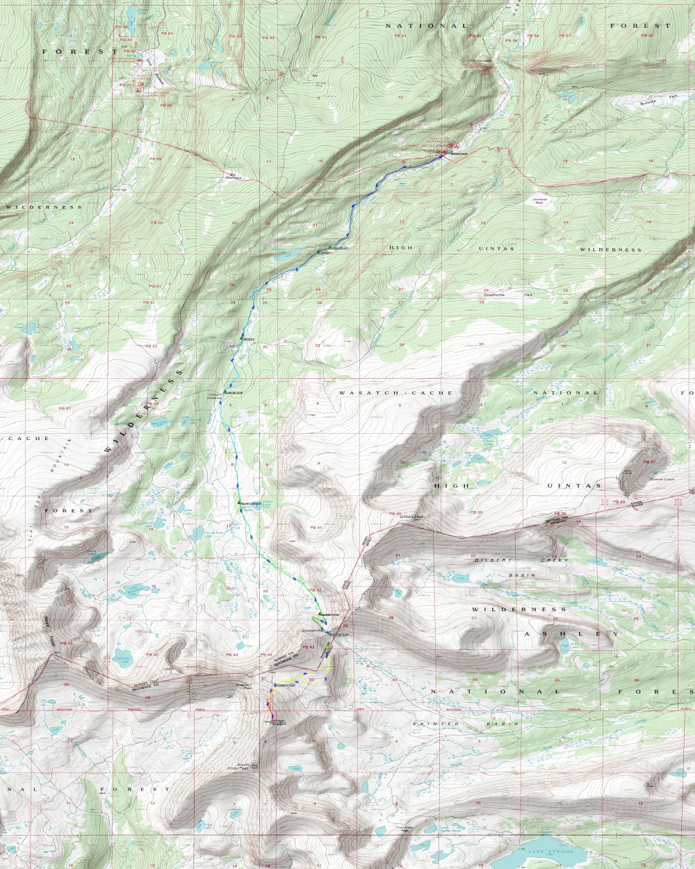
In the interest of providing route information to other climbers, I have included several files detailing the route we took to approach and climb Kings Peak. Figuring that most climbers will start from Salt Lake City, the Google Maps route from the Salt Lake City airport to the trailhead may come in handy. From personal experience, do not trust your Garmin automotive GPS to navigate you the correct way. It knows of some roads that cross private land and will take you well out of your way should you follow its directions. The key landmark, once you get down to Mountain View, Wyoming, is the large bronze elk statue on your right in downtown Mountain View. Make a right at the elk statue and continue out of town, turning left (which is basically going straight) onto the forest service road a few miles out of town. Eventually, the Garmin navigation caught up with the preferred way of getting to Henrys Fork but you have to listen to her "recalculating" for quite a while before she catches on. Google Maps on a smart phone works much better but if you want to navigate back to Mountain View using you phone, you'll have to make sure you explicitly download the route from Google Maps as there is no cell coverage once you leave Mountain View. The map to the right is a greatly-reduced copy of the entire hike and climb. Two additional copies are included, one about twice the size of the small copy and another at full topographic map resolution. The medium-sized file is about 1.75 meg but the largest file is over 17 meg, so be aware that it may take appreciable time to download. Printing it at 300 DPI takes about 13" x 16" (34 x 42 cm) but can be re-scaled to print on "ledger" or 11x17" paper. You can see the detour we took on the return from the summit to Gunsight Pass as we walked down to that band of cliffs below the Anderson Pass plateau. All of the waypoints mentioned in the narrative are noted on the map, as well. The map was prepared using TopoFusion software. While not free, it is modestly priced and digests the native Garmin .gpx files quite nicely. Note that the full map was created in two sections to stay within the image resolution limits of TopoFusion. The sections were then joined and cropped using the GIMP image-editing program. The input "GPX" files used to generate the track on the map are also available. For these, I recommend you right-click and download the files directly as they will not display cleanly in browsers. They will load into a Garmin GPS and probably into other GPS units which use GPX files. I have not looked into any translation utilities for various file formats. GPS track from Henrys Fork Trailhead to our camp below Gunsight Pass GPS track from our campsite to the summit and back to camp. |
|

|
Respectfully submitted by
Alan Ritter, August, 2014 |