|
The sign at Trail Crest marks a good spot to stop for a few minutes
and catch whatever oxygen is available at 13,677'. Our acclimation
hike up Glass Mountain and the two nights spent at Mammoth Lakes,
plus our night at 12,000' at Trail Camp had prepared us fairly well,
but we were both a bit winded by the time we finished the switchbacks.
|
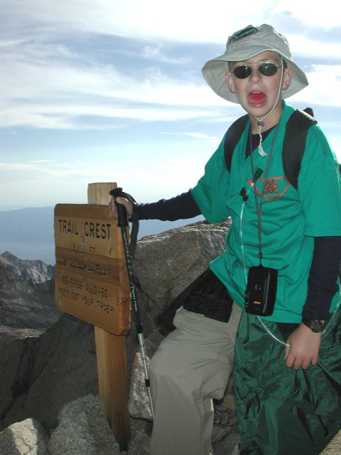
Nathan taking a breather at Trail Crest
|
|
back
|
|
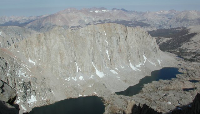
Looking West from Trail Crest
|
|
The view west from Trail Crest is impressive, with much of the
Sierra spread out in front of you. Interestingly, the weather
which would threaten us shortly wasn't blowing in from the west,
but more from the south, as became apparent as we approached
the summit.
back
|
|
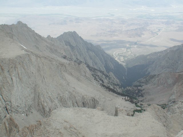
Looking East from Trail Crest
|
|
Turning 180 degrees and looking back east down the valley, you can
see all the way back to Lone Pine, although the Whitney Portal area
is hidden behind the break between the relatively shallow slopes
above Outpost Camp and the steep switchback area between there and
Whitney Portal.
back
|
|
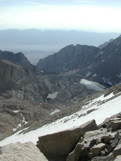
Looking Back Past the Switchbacks to Trail Camp
|
Looking a bit more to the south gives a view of the snowfield in
the gully just north of the switchbacks. Those adept with an ice
axe can make a swift descent to Trail Camp on the way back.
From the looks of it, it would not have been the spot to
teach Nathan ice-axe techniques, and neither of us was so
equipped on this trip, anyway.
|
|
back
|
|
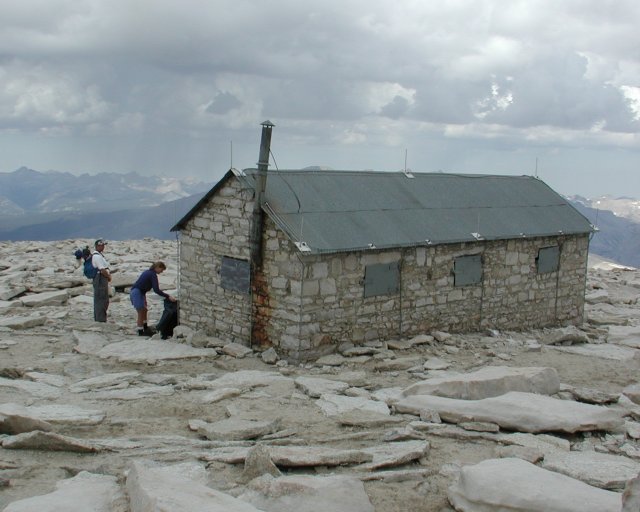
Mt. Whitney's Summit Hut
|
|
The summit hut begins to be visible about halfway between Trail Crest
and the summit, although it disappears again for a time as you get onto
the final gradual slope up to the summit. The summit log is at the back
(west) side of the hut. Despite its lightning rods and ground wires, it
is not the place to be during an electrical storm.
back
|
|
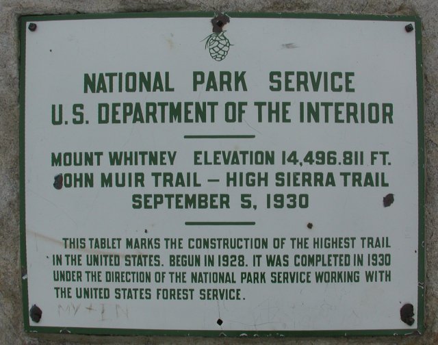
Marker at the Summit of Mt. Whitney
|
|
Will the real Mt. Whitney summit please stand up? The topo map
says 14,494'. This sign says 14,496.811'. The information at
the Whitney Portal Store (and their shirts) say 14,497.61'.
Either Mt. Whitney is growing, or there is a consistent upward
bias in more recent triangulation of the altitude of California's
highest point.
back
|
|
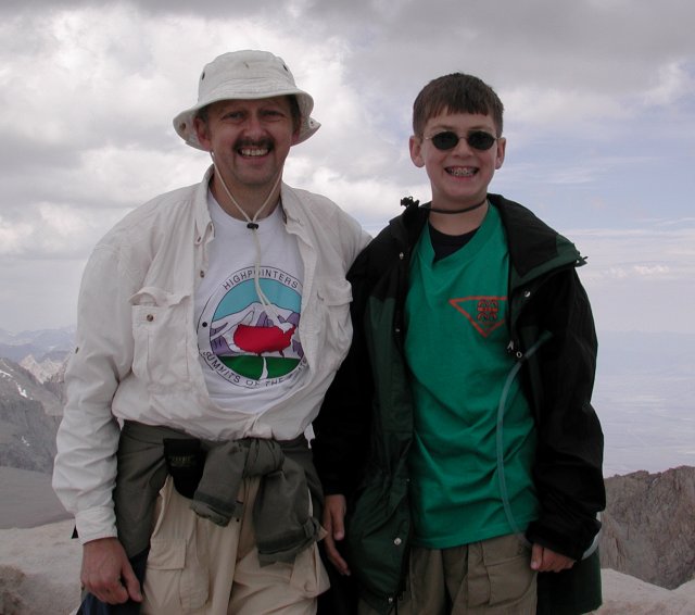
We Made It!!
|
|
With our heads very nearly (literally) in the clouds, we stood
atop the highest point in the lower 48 states. A new personal
high for both of us, if we believe either of the two higher
measurements of the exact altitude, our heads have now been
above 14,500'. At least to become 48-state completers, everything
is downhill from here!
back
|
|
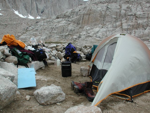
Home Sweet Home (away from home)
|
|
With the weather rapidly worsening, we beat a hasty retreat
back to Trail Camp. The afternoon's rain, hail and lightning
blew over for long enough to cook dinner and batten things
down for the night. This spot was typical of the Trail Camp
tent sites, with a rock wall providing some shelter from the wind
and a layer of sand and gravel hiding the worst of the underlying
rocks. Don't count on getting more than a couple of tent stakes
firmly set, though -- there weren't more than a few inches of
sand on top of those rocks, so the tent was held in place by
rocks piled on top of the stakes, instead.
back
|
|