Mt. Ritter: A Historical Perspective

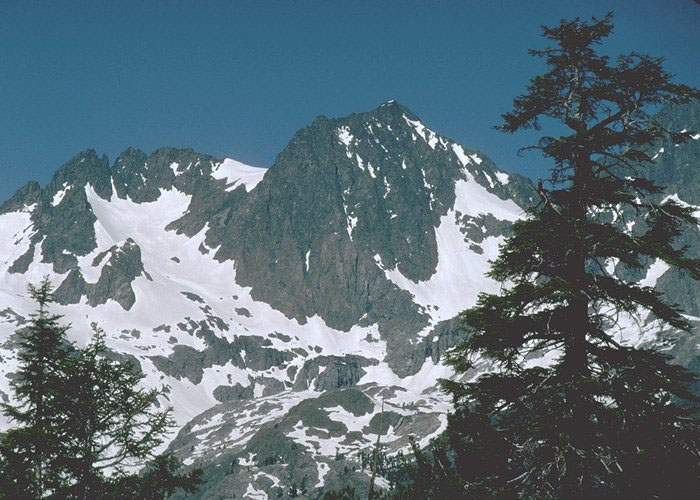
Mt. Ritter from the High Trail (Pacific Crest Trail) above Agnew Meadows, just west of Mammoth Lakes, CA.

Josiah Whitney

Josiah Whitney

Karl Ritter

Karl Ritter

John Muir

John Muir

back

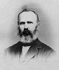
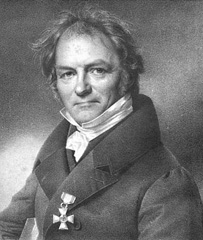
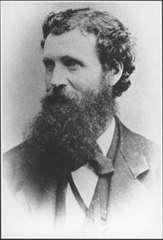
The history of Mt. Ritter is inextricably linked to these three men. Josiah Whitney, the great American geographer after whom Mt. Whitney, the highest peak in the lower 48 states, is named, studied geography in Berlin and learned of the science of modern geography from Karl (Carl) Ritter. As Whitney's team mapped the peaks of the Sierra Nevada, they chose to honor his mentor by naming one of the ranges of the eastern Sierra and its highest peak after Karl Ritter

At 13,150', Mt. Ritter is over 250' taller than its neighbor to the north, Banner Peak, 12,895'. It is the highest point in Madera County and stands out prominently against the surrounding lower peaks and ridges. Its relative isolation left it unclimbed until 1872. In October of that year, John Muir had led a party of artists south from Yosemite Valley in search of Sierra scenes. The mountains called to Muir, who wandered off in one of his typical solo journeys of exploration. He approached Mt. Ritter from the west and began his ascent via the western glacier that flows from the Ritter/Banner saddle into Lake Catherine. After reaching the saddle, he continued his ascent up the north face toward Mt. Ritter's summit ridge. Muir's own narrative then describes the crux of his climb:

"At length, I found myself at the foot of a sheer drop in the bed of the avalanche channel, which seemed to bar all further progress. The tried dangers beneath seemed even greater than that of the cliff in front; therefore, after scanning its face again and again, I commenced to scale it, picking my holds with intense caution. After gaining a point about half-way to the top, I was brought to a dead stop, with arms outspread, clinging close to the face of the rock, unable to move hand or foot either up or down. My doom appeared fixed. I must fall. There would be a moment of bewilderment, and then a lifeless tumble down the one general precipice to the glacier below. When this final danger flashed in upon me, I became nerve-shaken for the first time since setting foot on the mountain, and my mind seemed to fill with a stifling smoke. But the terrible eclipse lasted only a moment, when life burst forth again with preternatural clearness. I seemed suddenly to become possessed of a new sense. The other self -- the ghost of by-gone experiences, instinct, or Guardian Angel -- call it what you will -- came forward and assumed control. Then my trembling muscles became firm again, every rift and flaw was seen as through a microscope, and my limbs moved with a positiveness and precision with which I seemed to have nothing at all to do. Had I been borne aloft upon wings, my deliverance could not have been more complete. Above this memorable spot, the face of the mountain is still more savagely hacked and torn. But the strange influx of strength I had received seemed inexhaustible. I found a way without effort and soon stood upon the topmost crag in the blessed light."

The Mountains of California, Chapter IV, John Muir

Having been to that point on Muir's route, I can appreciate his quandary, for it was there, or nearabouts, that we decided discretion was the better part of valour and backed down from our second attempt.

back

From the summit, Muir descended the south side of Mt. Ritter's summit ridge and the Southeast Glacier in the left part of the photo above. It is interesting to compare the conditions during the cold years of the 1870s to today's much-lower snow levels. In Muir's day, the Southeast Glacier was an active glacier with an ice fall where it dropped over the low cliffs into the valley above Ediza Lake. Today, it is merely a large permanent snowfield. Muir's description paints a different picture:

"But in the midst of these fine lessons and landscapes, I had to remember that the sun was wheeling far to the west, while a new way down the mountain had to be discovered to some point on the timber line where I could have a fire; for I had not even burdened myself with a coat. I first scanned the western spurs, hoping some way might appear through which I might reach the northern glacier, and cross its snout; or pass around the lake into which it flows, and thus strike my morning track. This route was soon sufficiently unfolded to show that, if practicable at all, it would require so much time that reaching camp that night would be out of the question. I therefore scrambled back eastward, descending the southern slopes obliquely at the same time. Here the crags seemed less formidable, and the head of a glacier that flows northeast came in sight, which I determined to follow as far as possible, hoping thus to make my way to the foot of the peak on the east side, and thence across the intervening caņons and ridges to camp.

The inclination of the glacier is quite moderate at the head, and, as the sun had softened the névé, I made safe and rapid progress, running and sliding, and keeping up a sharp outlook for crevasses. About half a mile from the head, there is an ice-cascade, where the glacier pours over a sharp declivity and is shattered into massive blocks separated by deep, blue fissures. To thread my way through the slippery mazes of this crevassed portion seemed impossible, and I endeavored to avoid it by climbing off to the shoulder of the mountain. But the slopes rapidly steepened and at length fell away in sheer precipices, compelling a return to the ice. Fortunately, the day had been warm enough to loosen the ice-crystals so as to admit of hollows being dug in the rotten portions of the blocks, thus enabling me to pick my way with far less difficulty than I had anticipated. Continuing down over the snout, and along the left lateral moraine, was only a confident saunter, showing that the ascent of the mountain by way of this glacier is easy, provided one is armed with an ax to cut steps here and there."

The Mountains of California, Chapter IV, John Muir

Today's climbers are afforded several routes of varying difficulty. Most of these routes involve an eight-mile hike from Agnew Meadows to the glacial valley just above Ediza Lake. This is a very nice area in which to camp, so most climbers treat it as a multi-day backpacking trip. Strong, fast and dedicated climbers have day-hiked Mt. Ritter, but the thought of an eighteen-to-twenty-mile day involving roughly 12,000' of gross elevation change does not appeal to me, at least.

A western approach involves nearly double the approach hike, since it is about ten miles from Agnew Meadows to Thousand Island Lake and another three or so miles of tough cross-country hiking from there over North Glacier Pass and down to the Ritter Lakes, where the western routes begin. Of course, you could also use Muir's route up the Lake Catherine glacier, but this brings you to the same point on the mountain as the much-shorter Ediza Lake approach.

Whatever the approach, the routes (except for some very tough fifth-class routes straight up the east face of Mt. Ritter) involve snow and ice of varying steepness, some of which exceeds the 45-degree cutoff between second and third class snow climbing.

Can I claim a blood tie to "my" mountain? No, because we have not been able to trace my Ritter lineage beyond the late 18th Century in the eastern United States. However, the weeks I have spent trying and ultimately succeeding in attaining its summit lend a familiarity that more than closely approximates ownership of my eponymous peak.

back