|
Tower Hill, aka the Ebright Azimuth, the Delaware High Point |
|
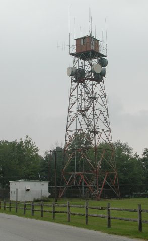
Tower Hill takes its name from this tower. It would appear that it might once have been a fire lookout tower, but it now fairly bristles with microwave relay and cellular telephone antennae. |
 |
 |
|
|
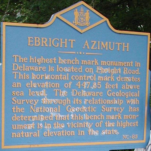
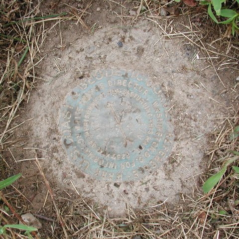
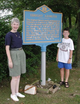
The plaque across Ebright Road from the USGS benchmark is a bit vague, noting only that the "Ebright Azimuth" is in the vicinity of the highest point in Delaware. The benchmark is set between the curb and the sidewalk, and is actually about six inches below current ground level. It takes a bit of careful scouting to find it, especially if the grass hasn't been cut lately. On a snowy day, you would need a metal detector and a shovel to uncover it! |
|
 |
|
|
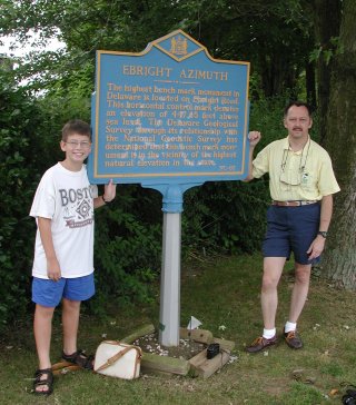
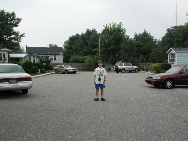
Our "summit photos" were taken at the plaque, across the street from the benchmark. |
|
 |
 |
|
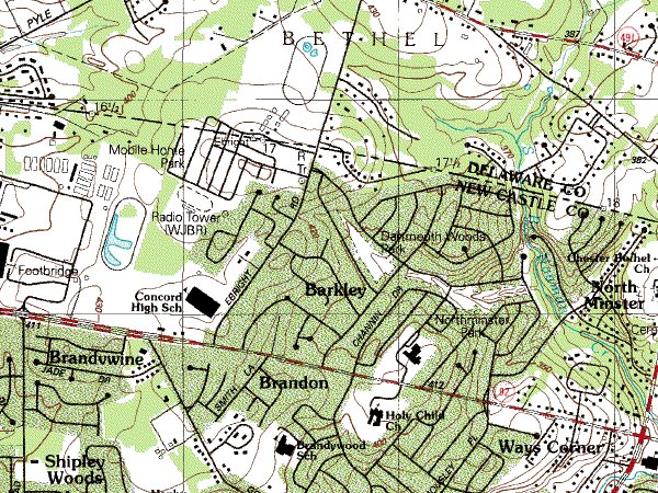
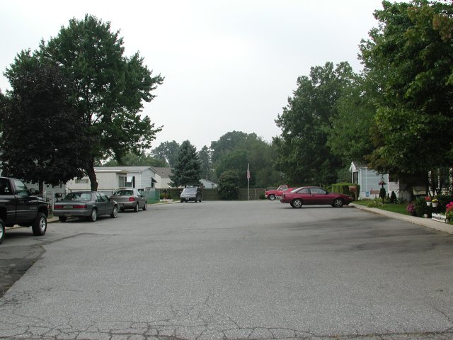
Now for the controversy! Look at the topo map fragment below. As you look at the area marked "Mobile Home Park" to the northwest of Ebright Road, you will see an oval heavy contour line to the south of the main street into the park, which crosses the second and third side streets off to the left of the main road. If you now look closely at the other surrounding contours, you will note that there is a 10-foot contour interval, and that the previous heavy contour "downhill" is at 400 feet. That means that the next contour is 450 feet, or two feet higher than the published altitude of the Delaware highpoint (448'). Very interesting! A visual inspection shows a very gentle uphill trend from Ebright Road as you go along the road into the mobile home park, and it appears that the side streets also go uphill a bit as they leave the main road. The ultimate question is, of course, "is that 450-foot contour natural or manmade?" If it is natural, then the USGS benchmark is not at the official highpoint of the state, but is merely a convenient nearby marker. If the entire area has been graded and landscaped in the process of clearing it and creating the mobile home park and streets, the 450-foot contour may be entirely man-made and thus does not exceed the natural elevation of the point marked by the benchmark. Perhaps the Highpointers Club could get permission to do some soil cores throughout the area and attempt to determine if the 450-foot contour is natural or man-made, and settle the issue. Or, the USGS benchmark may remain the "traditional" highpoint and continue to be recognized by the club as the official goal for highpointers. Anyone wishing to cover all their bases is certainly capable of reaching any and all of the "high ground" with a casual stroll along the mobile home park streets. |
|
 |
|
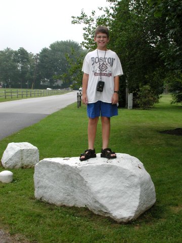 |
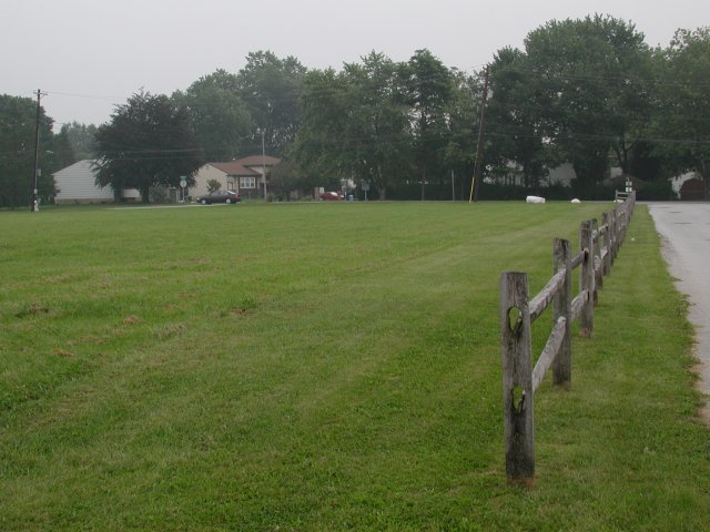
Zumwalt mentions in his book that there is a boulder at a point where the elevation is 451', and this is the largest rock around the area of the 450-foot contour. Of course, with its nice white paint job, it is impossible to tell if it is a natural feature, or trucked in from elsewhere. (I would vote for the latter, since this does not seem to be a very rocky area.) The other views below show the rise along the main street into the mobile home park, and the view from the "main drag" into two of the side streets. Proof of which point in any of these is actually the highest is left as an exercise for the reader. |
 |
|
 |
|
 |
|