|
Seven Card Stud...Highpoints in the Mid-Atlantic States |
|
Friday, 18 August 2000 |
|
Off once again on our annual highpointing pilgrimage, this time through the mid-Atlantic states. As usual, we left St. Louis after work on Friday. We drove as far as Louisville and settled down for the night. |

|
|
Saturday, 19 August 2000 |
|
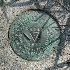
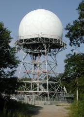
Saturday, we headed southeast from Louisville toward Black Mountain, the Kentucky highpoint. It is in an area honeycombed with coal mines, and the Penn-Virginia Coal Company, which owns the land with the highpoint, requires you to sign and file a release, just in case the mountain crumbles to dust under your feet while you are there. Finding Black Mountain is not terribly difficult, but the turnoff is a bit obscure. Coming southeast along state route 160, you have to turn sharply right just before you crest the ridge which separates Kentucky and Virginia. We went 100 yards past, but found a convenient gravel parking lot in which to turn around. From there, it is about a mile-and-a-half to the FAA long-range radar facility, and another quarter of a mile to the highpoint. According to my GPS, the Kentucky highpoint is found at 36° 54.855' N, 82° 53.648' W. |
 |
|
 |
 |
 |
|
Sunday, 20 August 2000 |
 |
 |
|
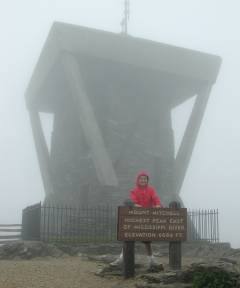
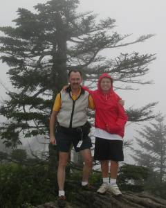
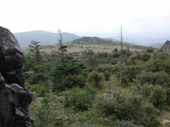
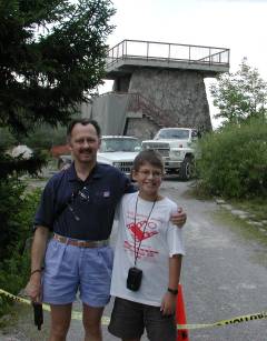
No sooner had we driven out of Asheville, NC, and headed up the Blue Ridge Parkway than we ran into increasing cloud cover over the Parkway. We had to slow to a crawl, taking at least twice as long as we had counted on to drive up to the Mt. Mitchell turnoff. After what seemed an interminable trip feeling our way along the Parkway, we arrived safely at the Mt. Mitchell state park and drove up to the summit parking lot. From there, it is a short stroll to the observation tower, sign, and USGS benchmark which mark the North Carolina highpoint at 35° 45.881' N, 82° 15.914' W. The benchmark is set into the rocks where Nathan and I are standing in the photo above. Needless to say, the "view" from the top of the observation tower was less than spectacular on this particular day. |
|
 |
 |
|
As we ate lunch at the park restaurant, we noticed the spider webs hanging from the overhang above the windows festooned with pearls of cloud condensation. Since the clouds gave no hint of parting, we bailed out from our plan of driving up the Blue Ridge Parkway into Virginia and opted for the lower-altitude interstate highway. We drove up to my cousin's house in Radford, VA, for the night. |
|
|
Monday, 21 August 2000 |
|
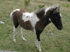
Monday morning, Nathan, my cousin LouDon and I made the two-hour drive from Radford down to to the Grayson Highlands state park and the Massie Gap trailhead for Mt. Rogers, the Virginia highpoint. Although not the highest point we would reach on this trip, Mt. Rogers would involve the most exercise, requiring a 9-mile round-trip day hike. The trail starts out climbing a grassy rise and passes by a spot occupied by Wilburn Ridge wild ponies, which are federally protected much as the wild horses on Assateague and Chinquateague islands. The ponies were out and quite friendly, walking up to get their heads scratched. (Hope that doesn't qualify as "bothering the ponies", but, hey, they insisted!) |
 |
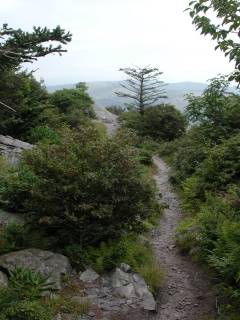 |
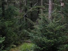
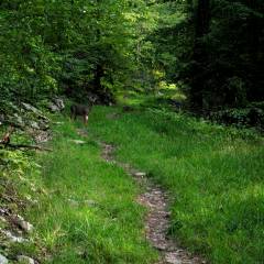
The trail then meanders up through an alpine landscape more reminiscent of the Sierra than most of the eastern U.S., with rocky outcrops and scrub vegetation. It would be a great springtime hike when the rhododendron are blooming, but we had to content ourselves with the green of their leaves and of the scrubby spruce which dot the landscape. |
 |
|
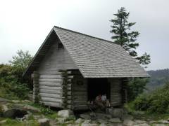 |
We paused for lunch at a shelter along the stretch of the Mt. Rogers trail which uses the Appalachian Trail. From there, we could see our goal for the afternoon about a mile distant. A short distance along, the summit trail branches off to the right and meanders up the gentle slopes to the top of Mt. Rogers, proper. |
|
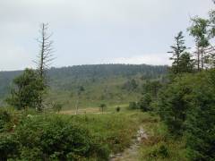
Looking north from the Adirondack shelter, Mt. Rogers is the ridge in this shot, every bit as unimposing as it appears. Its cover varies from brush to modest spruce forests, and its slopes are quite gentle up to its 5,729' summit. |
 |
 |
 |
|
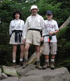
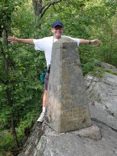
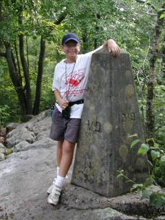
Another couple arrived on top of Mt. Rogers moments after we did, so we shared picture-taking duties so LouDon, Nathan, and I are all pictured. (No cracks about who got the good looks in the family, please!) The benchmark is located in the rocks just to the right of Nathan's feet at 36° 39.599' N, 81° 32.701' W. There is a method to our madness of having Nathan wear an MIT t-shirt on this particular hike. When I was researching the highpoints for this trip, I found that Mt. Rogers was named after a "William Barton Rogers." Being an MIT alumnus myself, that was a very familiar name, and a little further research proved that William Barton Rogers had been a geographer in Virginia in the first half of the 19th century. His wife was from Boston, and he was contacted by a group of people there who were interested in starting a technical university. In 1861, Rogers moved to Boston and founded the Massachusetts Institute of Technology. Interesting connections you run into while highpointing! |
 As is evident from the shot of the three of us, and from the view the opposite way from the summit boulder, there isn't a panoramic view of the surrounding countryside from the summit, proper. However, the views from the trail along the way more than make up for the dense cover which blankets the top of Mt. Rogers. |
|
Tuesday, August 22, 2000 |
|
"Country roads, take me home to the place I belong, West Virginia..." With apologies to the late John Denver, we headed northeast out of Radford and then cut back northwest, leaving the interstate at Harrisonburg and driving through the thriving metropolis of Judy Gap, WV. We found the Spruce Knob Road about a mile north of Judy Gap with no problem, but were then stopped by "Road Closed" and "Blasting Zone" signs. Arrrrgh!! To come so close and not be able to make it to the high point??? Not to worry. A short conversation with the construction workers and they told us about an alternate route, another road heading west about a mile north of where we were. Well, it was more like two miles, and a stop at the local post office to inquire again. The alternate route took us just beyond the construction closure and put us back on the Spruce Knob Road, albeit in "under-construction" condition with just the rough gravel underlayment down and not yet repaved. |
|
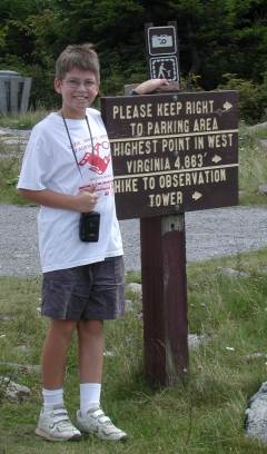 |
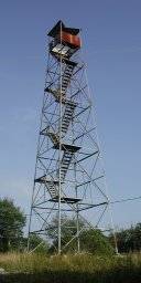
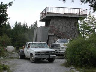
Once we got to the summit parking lot with this sign announcing the high point and indicating the path to the observation tower, we were greeted with more bad news. While they have the road closed, they are also working on the observation tower (sandblasting and cleaning the stonework, from the looks of it), so we had to take our summit photos from a few yards away while watching the workmen in protective gear do whatever it was they were doing to the stone tower. |
 |
|
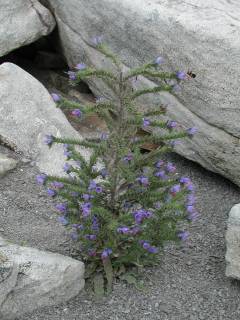
 On the way back to the car, Marcia pointed out this interesting plant. It almost looked like an already-decorated Christmas tree, in miniature, with the flowers at the end of each branch. What is it? Well, you'll have to find someone much more schooled in West Virginia wildflowers to tell you. It is about a foot tall and seems to like the rocky soil on top of Spruce Knob. |
At any rate, we took our summit photos at the yellow tape marking the beginning of the work zone, noting the GPS coordinates of 38° 41.997' N, 79° 31.978' W.
|
 |
We returned to the West Virginia highways, leaving the highpoint behind us, and turned north once again toward the West Virginia/Maryland line, seeking Backbone Mountain, the Maryland highpoint. In due time, we arrived at the old logging road which forms the trailhead, at 39° 14.728' N, 79° 29.483' W. In the not-too-distant past, finding the highpoint marker on Backbone Mountain required bushwhacking through the last half-mile of heavy brush, but the "Friends of the Maryland Highpoint", affiliated with the Highpointers Club, have improved the trail and it is now an easy walk all the way to the top. Not far from the road, we spotted this young buck on the trail. The cover was dense enough that my camera thought it needed to flash, hence the buck's bright eyes. A few yards farther up the trail, a doe and two fawns hopped across the logging road and down into the brush. |
 |
 |
|
About 100 yards from the Maryland highpoint, the trail crosses over the West Virginia/Maryland border. There is a branch of the trail which takes you past this stone marker on the state line, and another which avoids the little bit of rock-hopping that is necessary to traverse the outcropping on which the marker is mounted. |
|
|
When we arrived at the summit of Backbone Mountain, referred to as the Hoye Crest, we found the marker at 39° 14.250' N, 79° 29.131' W with a summit log and a picnic table. Underneath the picnic table was this exquisite tiger swallowtail which looked like it had just emerged from its cocoon and was still drying and firming its wings. |
 |
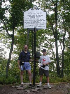 |
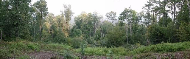
Another highpointer happened along as I was setting up to take our summit photo, and we swapped photographic duties. The view to the west of the highpoint is blocked by brush, but the view to the east, below, is open, thanks to some judicious clearing on that side of the mountain. Because of the haze that afternoon, only the nearest ridge was even dimly visible, but the view would be better on a clearer day. We walked back to the car and drove up to Grantsville, Maryland, for the night. |
 |
|
|
Wednesday, August 23, 2000 |
|
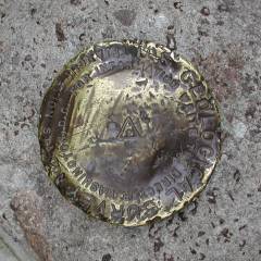
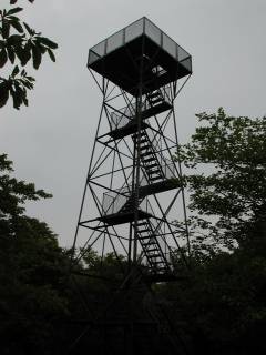
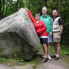
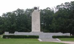
Mt. Davis, the Pennsylvania highpoint, is a drive-up, with a park surrounding it. We followed the paved paths over to the observation tower and a rather beat-up USGS benchmark embedded in the summit boulder at 39° 47.157' N, 79° 10.623' W. Being a drive-up, even Marcia got into the act and increased her highpoint total. It began to drizzle as Nathan and I walked up to the top of the tower. Fortunately, there was no sign of thunderstorm activity, or we would have avoided standing on what is obviously a great lightning rod, a metal tower at the top of the highest point of land in the whole state! |
 |
 |
 |
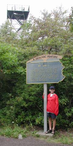 |
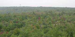
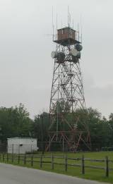
The plaque identifying the area as Pennsylvania's highpoint also provides a bit of geologic history. Down another path, there is an outdoor exhibit area which further details the geology of the area, as well as describing the settlement and development of the surrounding area. The view from the top of the observation tower is typically woodsy, with only the occasional microwave relay tower to punctuate the horizon. |
 |
|
| Leaving Mt. Davis behind, we drove eastward to Gettysburg, touring the Civil War battlefield and watching the "electric map" presentation in the visitors center. From there, we continued to Wilmington, Delaware, for the night. |
 |
|
Thursday, August 24, 2000 |
|
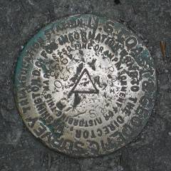
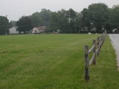
Tower Hill, aka the Ebright Azimuth, at 448', is the second lowest highpoint in the U.S., after Florida's Britton Hill. However, it is (somewhat tongue-in-cheek) often referred to as the "second most dangerous" highpoint, being in an intersection in suburban Wilmington, Delaware. Our drive to the highpoint was only a few miles, through a typically suburban mix of commercial and light industrial development along the main road, and then a residential area to both sides of Ebright Road near the highpoint itself at 39° 50.149' N, 75° 31.164' W. |
 |
||||
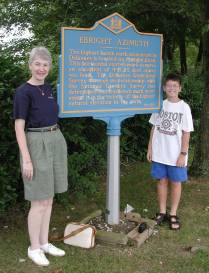 |
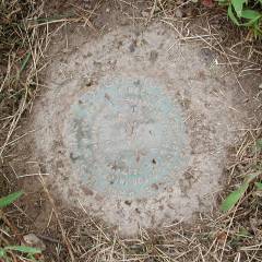
The sign identifying the Ebright Azimuth as the highpoint is actually across the street from the USGS benchmark. Ebright Road is a fairly busy thoroughfare, so some caution is required when visiting this most urban of the 50 state highpoints. |
 |
|||
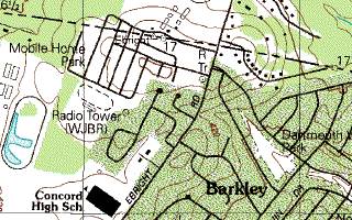 |
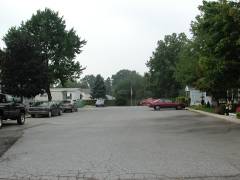
In fact, the benchmark and sign (on opposite sides of the street) may not be at the actual highpoint. Looking at the most-recent USGS topographic map, there is a closed 450' contour in the mobile home park about 100 yards west of the benchmark. The debate is whether the 450' contour is the result of grading and landscaping, or whether it is a natural feature. Time will tell. |
||||
|
 |
||||
|
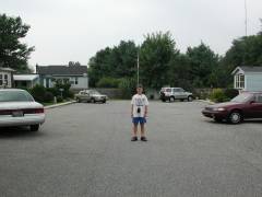
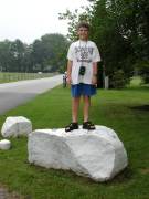
It has been rumored that the boulder where Nathan is standing is at 451', but this is probably an imported rock, and so isn't the natural highpoint. Looking south along the cross-streets within the trailer park, there is some rise in addition to the crowning of the streets. However, it may be that the entire 450' contour is the result of grading as the trailer park was created, and so would not qualify as the high point in any event. | |||||
 |
 |
||||
 |
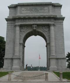
Leaving the benchmark, tower and controversy behind us, we once again pointed the Saab westward. Our first stop on the way back to St. Louis was Valley Forge. From there, we continued west through Pennsylvania. |
 |
|||
|
Friday - Sunday, August 25 - 27, 2000 |
|
Homeward bound, seven new highpoints "in the bag." We took our time, spending part of Friday at the NFL Hall of Fame in Canton, OH, and most of Saturday at the Air Force Museum in Dayton, OH. The Air Force Museum has an unmatched collection of aircraft from the beginnings of flight up to the present. Anyone who is any sort of aircraft buff could easily spend a couple of days there. Arriving home about mid-afternoon on Sunday, the trip totalled almost exactly 3,000 miles. |
|
Alan Ritter, 11 September 2000 |